Local favorites in Lofoten
Fantastic hiking trails in Lofoten – my top picks
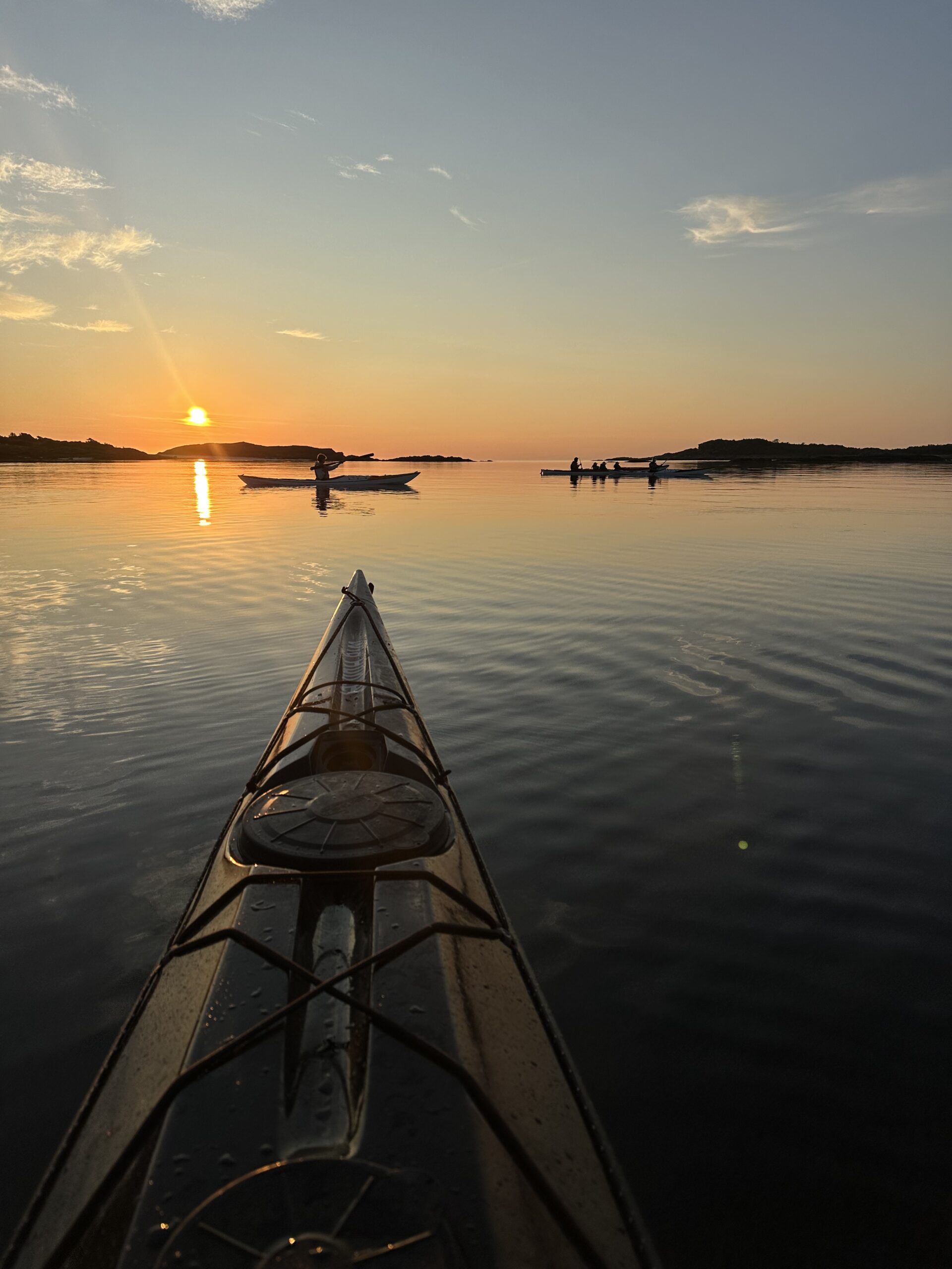
Lofoten has countless world class hiking trails – with so many possibilities making it hard to choose.
That’s why I made this overview of my favourite trails.
Lofoten consists of 5 primary islands that will surely take your breath away.
Here is where you will find inspiration to plan your own Lofoten adventure:
To plan the perfect Lofoten hiking trip you only need two apps:
UT.no – A great hiking planner that includes detailed maps with descriptions of the
these hikes. This article is meant to be used together with this App.
All you need to do is type in the names underneath – and the App will show you where the hike starts, the length and the difficulty.
A great tip is to download the maps and follow your position “offline” without losing too much battery.
YR.no – The best weather service that most accurately forecasts local weather.
Here you can type in the name of the place from this list and you will get a forecast of
what weather to expect.
Austvågøy (The island where Svolvær is on)
Austvågøy offers multiple great hiking trails and these are my favourites:
1) Matmora (787 meters above sea level)
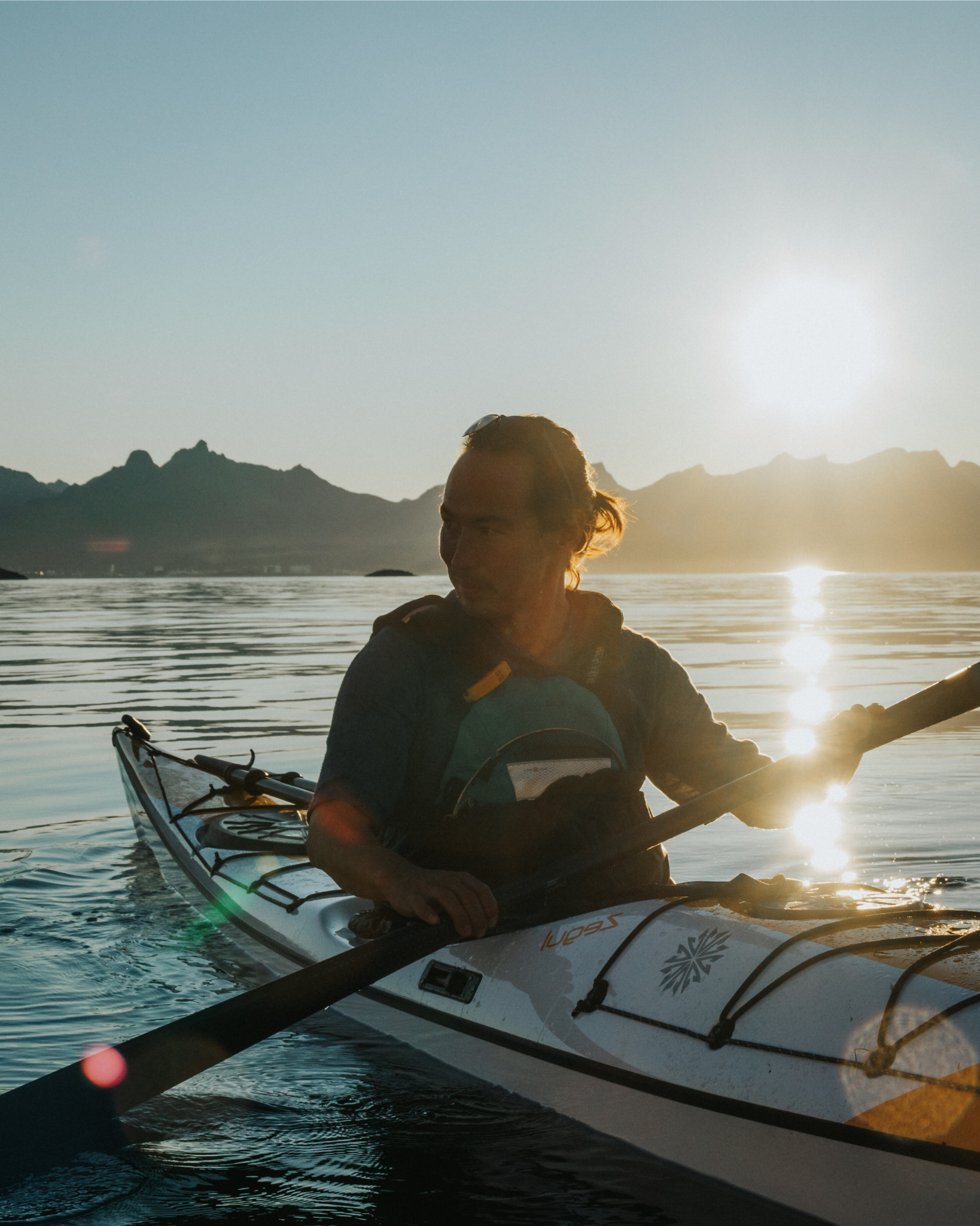
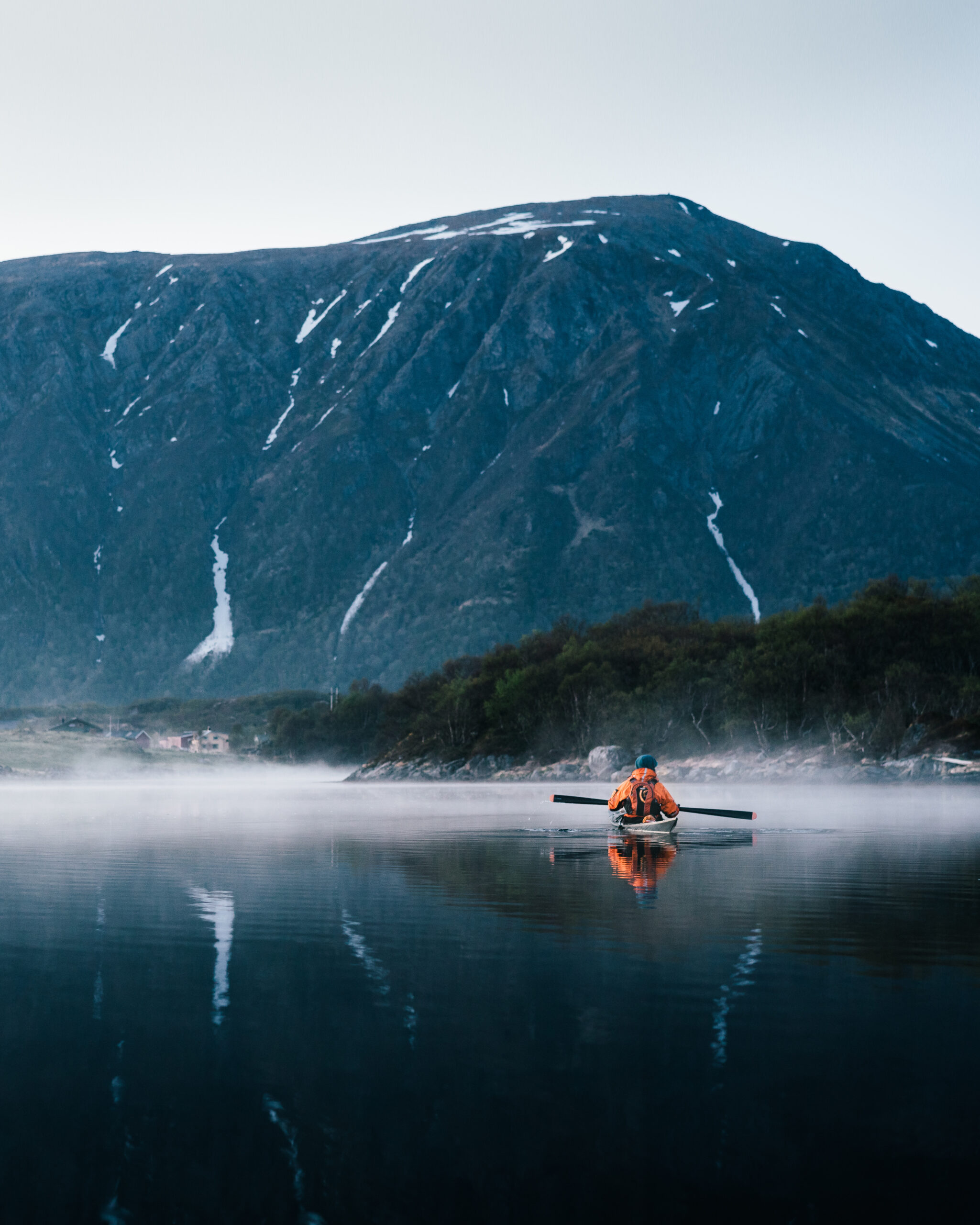
Matmora is located on the “outer side” of Lofoten, meaning the west coast facing the big Atlantic Ocean. This hike is simply a marvelous evening tour.
From the hike up you will see some of the finest views that Lofoten has to offer.
The beginning from Delp is a bit steep, but once you get up onto the plateau the path
is less challenging. On this tour the “journey is the goal” and it is not necessary to
reach the summit to catch the gorgeous view.
Perhaps the finest spot in Lofoten to see the sunset.
2) Glomtinden (419 meters above sea level)
This is a family friendly hike and a treasure that everyone will enjoy.
It follows an old path that was used with horse and carriage back in the days.
The track is found from both sides of the tunnel but we think that the track from the
Kabelvåg side is the finest.Once you get to the saddle, there is a gravel track that leads up towards the peak.
The last bit is rather steep and should only be done in dry conditions.
In fact the viewpoint below the actual peak offers a great 360 panorama you will
never forget.
3) Festvåg (189 meters above sea level)
This hike will give you a breathtaking panoramic view over the Lofoten wall.
From here you can see the town of Henningsvær and the “Vestfjord” ocean.
The trailhead is found centered in the valley as you look up.
We recommend taking the path to the right when you reach the lake on the plateau.
Cross the dam and follow the trail to the cliff to see something beautiful.
For the more adventurous hiker you can go all the way to the peak of Festvåg (541
meters above sea level).
Gimsøya (the island with the Golf course and horseback riding)
As a curiosity this island has the highest concentration of excavated viking
settlements. If you venture here it is easy to see why; this island has a great
combination of farming friendly areas and easy access to the ocean.
I recommend driving the circular tour around the island.
Gimsøy has miles of white sandy beaches and many spectacular sights.
1) Hoven (376 meters above sea level)
This hike is suitable for the whole family and is particularly fine during the afternoon
or evening light. The peak offers a wonderful 360 degrees view.
This will get everyone excited because here is simply so much to see.
Did you find the lake that is shaped like a heart?
2) Storknubben (599 meters above sea level)
This hike starts in the valley of “Jenndalen”.
Use the parking on your right side and get ready for a real hiking adventure.
It is a bit long for the youngest hikers but suitable for the people who need to burn a
little extra energy. Briefly said – this is a truly wonderful hike.
Vestvågøy (Lofotens biggest island, the one where Leknes is located)
As it is the biggest island, it provides a myriad of options.
Here are my all time favourites:
1) Himmeltinden (962 meters above sea level)
This should be considered as a whole day hike. On a clear day you may see all the
Lofoten mountains from the summit. It is a bit long and steep for the smallest.
The route up to the top is quite long but the view is really worth it.
A tip is to plan enough time (approx. 5 hours) sog that you may enjoy every step of
the way.
The summit is the highest on the island and a great place to get “an overview”
An easy alternative is to take the walk from “Haukland beach” to “Uttakleiv”.
The route over the pass is an easy walk. Upon arriving at the beach you can take the
coast route along the sea making this a round trip for the whole family.2) Offersøykammen (436 meters above sea level)
We think that this is Vestvågøys finest view. It has a somewhat steep beginning but
once you get up onto the plateau it is an easy and enjoyable walk.
A tip is to park at the end of the old road.
It takes around one hour up so do not rush the steep parts.
Flakstadøya (The island across the scenic bridges)
1) Kvalvika strand (168 meters above sea level)
A great trip for the whole family. The hiking starts directly across from the parking
and is enjoyable the whole way. Enjoy the view from the saddle and plan enough time
on the beach to explore all the little fine things.
The beach is so beautiful making it hard to leave.
The extra energetic people can climb all the way to the top of Ryten (534 meters
above sea level).
Moskenesøya (The island Reine is located on)
1) Reinebringen (448 meters above sea level)
Sherpa stairs have recently been made on this very popular hike.
As of early 2020, they are not quite finished and the top part is steep and may be
slippery when wet. Otherwise this is a great and easy hike and you will find benches
to rest tired legs. A great tip is to bring something cozy for the summit and have
enough time to really take every detail in.
“Above all, do not lose your desire to walk. Everyday, I walk myself into a state of well-being & walk away
from every illness. I have walked myself into my best thoughts, and I know of no thought so burdensome
that one cannot walk away from it. But by sitting still, & the more one sits still, the closer one comes to
feeling ill. Thus if one just keeps on walking, everything will be alright.”
― Søren Kierkegaard
Lofoten stories and background:
The squire and the fisherman
Squires
Class divisions system has always characterized different societies, and life in the fishing
village was no exception. The squires were both in the social and economic elite in these
small villages. Their prosperity was clearly visible to all, and the towering white squire house
(væreiergården) was eye-catching for the visitors. Also the pretty gardens that often adorned
residence of the owner were a symbol of wealth and class. No one should fail to see that thiswas where the great people lived.
The squire literally owned the whole fishing village. There were fish processing, drying racks,
fishermen, and perhaps also stores. The fisherman who came to the place got to rent a rorbu
from the squire on the condition that he undertook to shop for food and equipment in his
store, and supply him with fish. In this way the squire got a unique power over the fishermen
in his place. Revenues for the squire were significant, but this was not only due to cabin rental
and sale of dried fish. It was hard work and academic excellence in economics and fisheries
underlying.
There have been many stories about squires over time, and the fishermen had divided
opinions on these. It has both been said that they were greedy, power-hungry people who
cheated the dutiful fisherman and that they were caring people who helped the fisherman in
distress. What is true or not true is hard to say, but it is certain that most squires were
concerned that residents of his village were good. He gladly gave free land to allow
construction of churches, infirmary, and the like.
The squire as a person was disputed. He had money and power, and could thus determine
many people’s lives. The trader could also require duties of their crofters. The fishermen were
dependent of the squire’s will because he had a monopoly on all trade in the vicinity. There
was thus a large class divide between fishermen and squires. One can clearly see this by the
surnames of squires who did not have the typical “-sen” names (Hansen, Jensen, Johansen
etc.) which was and still is very common in Lofoten. Such “upper class names” could be Zahl,
Dreier, Sverdrup, etc.
Class distinction was indeed maintained by the children squires who married with children of
officialdom. A priest daughter could become a squire’s wife, and it grew close family ties
between squires and officials. This represented an economic and social elite in Lofoten.
The combination farm
Austvågøy and Gimsøy have relatively good agricultural potential on the seaward side of the
islands. However, they are small compared with Vestvågøy in the middle of Lofoten. The
island is one of the largest rural municipalities in the Nordland county. In the middle of the
island there’s large flat fields and many farms surrounded by high, protective mountains.
Subzero temperatures can be more noticeable in this “inland” than out in the villages by the
sea. Further west in the ocean is Flakstad Island and Moskenes Island. Here there is less land
and farms and they become fewer and smaller the farther west you go. The islands appear to
be mainly mountains and rocks. And when this is said, Flakstad lush with its rural villages on
the outskirts compared to Moskenes. Moskenes is very bottom of agricultural statistics.
“He’s on a boat and she’s on shore”
Out here the most important has always been the fish, but far into this century, the Lofoten
families were dependent on a small farm and exploiting the earth’s resources. In this
mountainous kingdom could also families without properties hold animals because of the
green, fertile but inaccessible mountain hay. The people climbed high into the mountains to
provide feed for cattle and sheep. The good opportunities for fishing, combined with livestock
and a small farm, was what gave livelihood.
A fish farmer’s home had four legs to stand on as an economic foundation:
▪ The fishing season. The Lofoten fishery after christmas, and some were part of the Finnmark fishery at Easter.
▪ Home fishing, year around.
▪ Field farming: potato and carrot
▪ Husbandry: Cattle, sheep, goats
The women had primary responsibility for the home and small farm with livestock. They took
care of the subsistence economy. This provided important revenues that do not appear in tax
accounting and paperwork. The man took care of the fishery. This gave the money to pay
taxes and to buy essential goods such as flour, wood, kerosene, sugar and utensils.
Throughout the 1960’s and 70’s it was common to put down the smaller fisher farms. The men
were fishermen all year or did other work. The women took a job outside the home. Today,
there is few that run the traditional combination farm. Small farm buildings still remain
typical of Lofoten landscape. In addition, it currently appears that several young families take
up the combined operation forma. The Voice of the municipality in the 1990s passed out and
encouraged people to start with sheep – and they have succeeded in it. In 1994, the Lofoten
lamb named the world’s best lamb – maybe that is why more people have wanted to start with
sheep?
The history of the rorbu
Demand and supply
Before the year 900 the saga tells that boats were fitted along the coast to go to Lofoten and
participate in winter cod fishing season. In addition to typical home fishing was heard along
the coast of the extremely valuable winter fishery off the Lofoten Islands. People began to
travel for days and even weeks in open sailing boats and rowing boats, to participate in the
rich Lofoten fishery. And it is said that they lived and slept under overturned boats all winter.
The influx of fishermen eventually created need for better housing conditions. It was when
King Øystein the early 1100s, decided that it would be built cabins for visiting fishermen in
Kabelvåg, old Vågar. This says something about how important this fishery was for the
country’s economy.
But it is not certain that it was King Øystein who was the first to build Rorbuer. It was in fact
rorbuer also before that time and we have indications that the fishing season, originally called
Våga fishing, as livelihood in export purposes is considerably older.
In Nusfjord in Flakstad, there was in 2004 found remains of what appears to be five,
particularly old shacks. The oldest of these strains presumably from somewhere between year
400 and 500, perhaps as early as 425 BC. There are no rorbuer as we know them today, but
they have a frame of wood, and was covered with turf. This finding, together with other
findings made in the Lofoten Islands and elsewhere, shows that the fishing industry was
established long before King Øystein time.
The name RORBU.
What does it mean? BU denotes a (small) house and is related to live (Norwegian:
bo). Thus a smaller house to live in, but it is also used in other contexts, for example a toolshed.
The first part of the word RORBU comes from the word to row. For centuries the fishermen
came in rowing, and the motorized fishing boats didn’t come until the beginning of our
century. One literally rowed fishing. Even after three generations of motor boats it is still the
vernacular to “row fishing”. Rorbu is thus the house the fishermen lived in while they were
rowing fish.
Environment
The rorbus was originally built entirely down to the shoreline, often on piles in the sea, and
the natural access for rowing straight to the shed. In many fishing villages it became very tight
settlements, where the red cabins – and the fishing industries – dominated. About the
characteristic red color of the boathouse we can say that the red paint was the cheapest and
therefore the most widely used. Along with the large number of racks for drying fish this
created a distinctive building environment in Lofoten’s fishing villages.
A traditional fisherman’s cottage consisted of two parts: one part was built by logs. Here ate
and slept fishermen. In this room there was a stove for heating and cooking. The room was
used for maintenance of equipment and sometimes baiting the line. The bunks fishermen used
were often placed under the roof, so that the limited floor space was not occupied by the beds.
There were wide bunks, where they were two and three man in width during major fur rugs
and thick woven rugs. The second part of the hut was first built entirely of single planking
where the wind blew through the wall, and snow could lie inside the walls in the winter. This
room was used for storage of equipment and the Lofoten chests which the fishermen brought,
which contained food, clothing and other personal belongings. In each cabin lived and worked
8-10 men closely together for 2-3 months.
New objectives and modernization
Around 1960, when hundreds of rorbuer were empty all year round and many were
demolished or blown down by the winter storms, some of the better cabins for the first time
got rented out to tourists who came to Lofoten.
Over a 20 year period, the number of tourists who wanted to stay in the cabin increased, and
the owners restored and modernized their rorbuer. The old main room could often be left as it
was, while the part that was used for storing tools and other equipment have been insulatedagainst cold and furnished with shower, toilet and one or several bedrooms. While it
previously was necessary to carry water to the cabins, we today can say that all cabins have
running water. Lofoten currently has between 300 and 400 rorbuer. Of these, nearly 100
newly built rorbuer, or cabins in rorbu style, which have in fact never been used by fishermen.
They are still popular as accommodation for tourists who want distinctive accommodation fit
during their stay in Lofoten. Without letting of rorbuer to tourists we would probably found
not more than a handful of rorbuer in Lofoten today. Tourism has been directly responsible
for an important part of our culture, rorbuer, has survived in its original environment.
Boat houses
In the fishing villages one can find major buildings for storage of the fishermen’s catch. These
piers are usually built in two to four floors, with rooms furnished for the accommodation of
fish workers and boat crew. Since much of this accommodation was used by fishermen, these
are sometimes also referred to as rorbuer. To distinguish this type of accommodation from the
traditional, detached rorbuer, we use the term SJØHUS (boat house or sea house) about these
larger buildings.
Accommodation in boat houses are often more modern than the old rorbu cabins, and in many
cases these units are more spacious than the traditional rorbu. Some boat houses functions as
hostels allowing multiple tenants share a common kitchen and living area.
Stockfish
Lofoten is one of the best places in the world for the production of dried fish. The further west
you travel in Lofoten, the better, and it’s especially beneficial in Værøy and Røst. It is an
experience for both the eye and the nose to visit the islands in May, while the slopes and
hilltops are covered with fully laden stockfish racks. Proud islanders turn out his arms and
says, “Here hang our money!” or “Mmmm, the smell of money!”.
The process
When the cod come in to the fish recepcions the head and entrails gets removed. One then ties
two and two together and hang them on racks. No other country can compete with this way to
preserve food. Many have tried; none succeed, such as Iceland, which had last trial year in
1992. This because there are such strict requirements of drying area: The air should not be too
dry. The temperature should be appropriate, so low that the fish won’t get destroyed by
maggots and flies, but still, the air being so hot that it does not freeze. A constant wind drag
with a hint of salinity provides the best results. These factors are found in Lofoten, and are
helping to make stockfish an extraordinary item that has become popular far beyond Norway’s
borders. We have sources that say that it was exported dried fish already in the sixth century
(sale of dried fish from Hålogaland to Uppsala). Stockfish is mostly taken down from the
racks before the middle of June. Traditionally, 12 June was fish collecting day (“feskhentar-
dag”). Now it’s the fish grader’s to sort the fish by quality.
Clean food without additives
Dried fish is a healthy product, chemically free from artificial additives and created as we say
“of air and love.” Manufacturing process is resource friendly and arguably the least energy-
intensive process in the world. All values in fresh fish are kept in stockfish, only the water isremoved. The nutritional value of a kilo of stockfish equals about five kilos of fresh fish.
The stockfish is durable for years under reasonable storage conditions. Upon dilution it sucks
up all the moisture again and to transport it is therefore a unique food product to export.
Stockfish was also one of the first foods from animal kingdom which was the subject of
international trade.
Classification
It is said that the stockfish quality grader is an artist in his field, he will quickly see, smell and
consider. The fish is roughly sorted into three main groups: 1 Prima, 2 Second and 3rd Africa
(Tertia). Then an ocean of different sorts follows, up to 30, according to quality, thickness and
length.
The origins of this must be subscribed the Hanseats’ (and later the trade men from Bergen’s)
ability to exploit different markets’ requirements for taste and size. In particular, the stockfish
to Italy is fine graded. There are at least 12 different grades of prime Lofoten stockfish. In
addition, the second class have at least 6 grades. Prima Lofoten cod is sorted by length,
weight and appearance.
Most of the stockfish is exported, which is reflected in the names of the sorting grades.
Exports of dried fish were in the 1300s 80% of export earnings in Norway. In 1994 it was
exported 4824 tons of stockfish at a value of NOK 392 million. 30 countries are on the list of
buyers of this precious commodity, and at the top of the list is Italy, importing 3946 tons. It is
therefore not without reason that the Mayor of Røst says: “God bless the Italian housewife
and her kitchen! May the Italian eating habits remain!” Other important buyers in 1994:
Croatia, USA, Switzerland, United Kingdom, Nigeria, France and Germany.
VÅGAN MUNICIPALITY
● Includes the islands Austvågøy, Skrova and Gimsøy
● Numbers: 477 square kilometres (184 sq. miles), the biggest in Lofoten in respect of size,
approx. 9030 inhabitants
● This is the municipality in the northern part of Norway with the largest production of
salmon and trout; in respect of the traditional fishing industry it is the second largest. The
clean seawater gives perfect conditions for breeding. There are 12 fish farms in the
municipality, and the annual production is around 7000 tons.
● Formerly, there was extensive Sami settlement. Many of the place-names in Lofoten are
of Sami origin. For example, the name Svolvær comes from ‘Soulavarre’, which can be
translated as “mountains behind small islands”. The Samis here differed from those of
Finnmark, and were so-called “south-Samis”. They did not herd reindeer, but lived from
the sea. They were Christianised quite quickly. This, and inter-marriage between
Norwegians and Samis contributed to the almost total disappearance of Sami culture.
● Austvågøy is the only island of Lofoten where moose can be found – the latest count
showed a number of 126. The moose originally swam over from the mainland, and some
of them swim back. There are few wild animals on the islands; otter, mink, stoat, foxes
and hares.
Svolvær
● The first city in the islands (status granted 17.05.96), and the unofficial ‘capital’ in
Lofoten. With only 4290 inh, it might be one of the smallest cities in the country (or even
the world?)
● Built upon and around small islands
● Well-protected harbour
● The statue of the fisherman’s wife has been placed by the passage to the harbour. She
watches for those who went out to sea, but never returned
● Shops, “wine monopoly”, cafes, pubs, bars, discos, hotels
● Cinema, city theatre, several galleries
● Vågan civic centre
● Svolværgeita: 569 metres high (1866 ft.). Brave climbers do the jump between the two horns.
Distance between them is 1,5 m (or 5 ft.). At a wedding here in 1994, the bride and groom stood
on each horn, and when they had been wed, the groom jumped to his bride. They are still married.
People fear that the goats will fall down, but so far they are standing on safe and steady ground.
● Short-track airport, express boat to Bodø and Narvik, ferry to Hamarøy, in addition to the daily
calls by the coastal steamer. Express bus to Narvik. Shipyard in Osan.
● Secondary school
● Sport hall, skilift, athletics-court, football-ground
Skrova
● 300 inh., maybe the island with the highest number of millionaires in relation to the numbers of
inh. in the world: 30 of them are millionaires, or 10 %. This is due to the fishing industry as well
as whaling (do not mention to other nationalities than Scandinavians, if so, know the risk of
sanctions…). Ellingsen AS, whaling and processing of meat.
Industry
The main industry in Skrova is fishing, fish farming, and whaling. It is one of the largest whaling
stations in Norway, taking in about half of the whale meat in Norway each year.
The heyday of Skrova was in the 1970s and 1980s, when fishing and whaling were booming. Since the year
2000, there is now only one fishing factory, called Ellingsen’s.
The mountain is a really great and easy hike, well marked and an epic view of the entire Lofoten wall.
Also the beaches, little Hawaii (local name) are really a must see when visiting the island.
For much more info about the place: place read the Shark drunk : the art of catching a large shark from a
tiny rubber dinghy in a big ocean by Morten Andreas Strøksnes which is an amazing book about the history of the
place. When sailing to Skrova – you will pass the ocean stretch called “Hølla” which translates into “Hell” because so many people have lost their lifes there in horrible weather. Think – pre weather forecasting times when out fishing
in January to catch enough arctic cod to feed your family back home at the farm.
The battle of the Trollfjord:
The Trollfjord is a small fjord in Lofoten. The fjord is 2,5 km long but only 100 m wide at its narrow
entrance. The beautiful fjord has steep-sided mountains surrounding it and is a spectacular tourist
attraction in Lofoten today. Trollfjorden also was the scenery of one of the most well-known conflicts
related to the cod fisheries in Norway. It is the most famous fjord of Norway. Some of the credit for
this must be given to the German Emperor Wilhelm II, who in the summer of 1889 embarked on his
first Northern Norway voyage. Later there were several trips to the north. He often visited Digermulen
and the Trollfjord. Tourists followed in his wake. It is rare for “Skrei” (arctic cod) to migrate up in the
Raftsundet, but in 1890 this happened. “Skrei” was fished here in February and eventually the
Trollfjord was also filled with “Skrei”. The Trollfjord is therefore also known for the battle that took
place here on March 6, 1890, when the rowboat fishers went into action against the steamboat owners
that tried to block them from fishing in parts of the Trollfjord. This was in many ways a culmination of
the conflicts that had already taken place between larger, steam-powered net boats and the traditional
fishing from smaller open boats.
The shipowner and trader Ole J. Kaarbø had organized fishing with nets from steamboats, and thus
closed out fishermen with conventional gear from the innermost part of the fjord, where there was a lot
of “Skrei”. The fishermen thought the exclusion broke with the public right, and after a few of the
fishermen had broken the barriers.
The night before (March 5), representatives of the small boat fishermen had asked the steamboat
owners to help break up the ice that the Trollfjord was covered with so that the fishermen could come
the next day. The steamboats did this, but instead of opening up to the fishermen, they closed the
innermost part of the fjord with nets. They demanded payment from the fishermen to let them in. The
fishermen would not accept this, and eventually there was a fist fight between the small boat
fishermen and the steamboat crews. Among other things, the fishermen were flushed with hot water
from the steam boilers aboard the big boats.
The battle of the Trollfjord became known in the future and involved large parts of the coastal
population. The Norwegian Parliament also gradually took action and accelerated the work on a new
Lofot Act. In March 1891, the Norwegian Parliament passed amendments to the Lofoten Act,
which prohibited the use of nets during the Lofoten fishing. Essentially stopping big boats from
fishing in the Lofoten sea for arctic cod fish.
The battle of the Trollfjord is often regarded as the conservative fishermens resistance to new technology. But
the conflict was not so much about technology as it was about private capitalism and the wage system. The
fishermens opposition was against a future as wage earners. Traditionally the fishermen owned their own boats
and tools and were their own lords. The new fishing companies represented a new way of life on board the steam
ships as employees and wage labourers.
Every winter from February to April the skrei, or North Atlantic cod, wanders into the
Vestfjord basin and the fjords of Lofoten to spawn. In 1890 the skrei went particularly deep
into the fjords, even into the narrow Trollfjord. Most fishermen those days used small
traditional open boats with oars and sail. But a few shipping companies had been established
and they used new technology steam-driven fishing ships with closing nets. One day at the
beginning of March this year steamboats blocked the fjord mouth of the Trollfjord with nets.
The steamboats then caught the fish inside but prevented the small boats to get access to it.
The traditional fishermen raged and tried to enter the steamboats. The rising among the
fishermen, their loud protests and demands for better conditions also reached the Norwegian
government. As a result closing nets was prohibited in the Lofoten fishery from 1893.
Vågan Church
called the Lofoten cathedral due to its size, room for 1200 people, largest wooden church north of
Trondheim
● Built 1898, the first church at this very spot was built by king Øystein during his visit around 1120
AD. Ordered that a large church be built to accommodate all the fishermen during the Lofoten
fisheries.
● The Troll’s stone: the trolls did not appreciate a Christian church being built, so the
biggest of them threw a stone at the church. He missed, though, and burst with anger, and
the hollow left by his thumb can still be seen in the stone. A different theory claims that
king Øystein used this stone as an altar when he held the first Christian service.
Oscarskaret – ‘The Kings’ Stone’
The four recent kings Oscar, Haakon, Olav and Harald have all written their names in gold
during their respective visits. King Oscar came in order to celebrate the opening of the roadbetween Svolvær and Kabelvåg.
Kabelvåg
● 1990 inh. Despite two fires (winter of 1991/92 and Sept. of 1996), a lot of the old
architecture has been saved. Many of the houses have been re-built in the old style
● Home of many artists, art school, video-textile- and ceramics-workshop, folk high school
● History: At Storvågan (the area of Nyvågar), there are traces of settlement back to the
Stone Age. There was an important city there in the late 1000s called Vågar. Centre of
trade and church administration. King Øystein ordered that the first rorbuer (fishermen’s
cottages) be built here, because the only shelter the fishermen otherwise had was created
by turning their boats upside down and sleeping underneath them. Being a clever man, he
realised that if the fishermen froze too much, they also worked less, resulting in less tax
revenue for him. The king also ordered that the trade of stockfish should be channelled
through Vågar, and the annual summer sale of the stockfish attracted merchants from
Bergen who traded grain for fish and cod-liver oil. The painting “Dancing Bear” by Otto
Sinding is exhibited in the gallery Lofotens House, and portrays his vision of the trade
days in Vågar. However, the Black plague reached Lofoten in 1349, and the ruling
chieftains’ family died. The king then transferred the land to the state and denied the
Lofoten traders the trade privileges. Simultaneously, German merchants enjoyed great
power, and when the king prohibited them from going to Vågar to trade, the Germans and
the Lofoten merchants met in Bergen at Tyskebryggen. This was the beginning of the
Hansa era, which was a drawback for Vågar – the city changed into being an ordinary
fishing village. The Germans had a good nose for quality, and ranged the stockfisk into
25-30 classifications.
Storvågan: The merchant Caspar Friedrich Lorch came to Storvågan in 1811.. Having
been given the privilege to trade and run inns, he built rorbuer, and expanded the fishing
village.
Ørsnes
Small religious congregation, originally from the US. They are strict puritans, dance and
contraception is prohibited, which causes childbirths above average. Several years ago, the
congregation were granted their request to run a private school for their children. This caused
the closure of the Ørsnes primary school, because there were too few pupils remaining.
Vågakallen
942 metres (3090 ft.), and a difficult ascent for climbers. It takes 3,5 hrs to ascend the summit
and 2 hrs to go down, and it is preferable to use an experienced guide. When studying the
mountain from the sea, it looks like the figure of a man with his arms outstretched. According
to tradition, the young lads who are participating in the fisheries for the first time must take
their hats off to the mountain when passing it, to secure a good catch. The tales tell that
Vågakallen was a powerful troll who stood high up in the Lofoten watching the activities
along the coast. One day he found a goat at his fields, which he did not know, and presumed it
belonged to a troll in Svolvær. He did not like the idea if some one else’s goat eating his
grass, so he grabbed an enormous axe and threw it at the goat. He missed, though, and the axe
went far out into the sea until it hit a mountain. The mountain split in two, and is today the
Trollfjord. Then, he threw the goat to Svolvær. When the sun came up, the goat turned into
stone, and this is how Svolværgeita was created. Later the king Suliskongen shot an arrow
after vågankallen, that why he leans to one side. The arrow pierced the mountain Torghatten
further down south by the “seven sisters”. All of these stories are really a roadmap for
traditional fishermen to find the way to vågankallen and back again. Waypoints to reach theimportant lofotfishing.
Rørvikskaret
After several accidents and problems with avalanches blocking the narrow road, the tunnel
was built in 1975. The tunnel is built under masses of rocks that have fallen down during
landslides, and was at the time the most expensive tunnel in the country due to the safety
requirements. It fell down just after it was finished, and small rocks sometimes fall down from
the roof.
Rørvikvannet
Freshwater lake supplying Henningsvær with drinking water. The water is transported
through a water pipe lying next to the road to the village. It could not be laid underground
because of all the rocks. The fact that the water is constantly flowing, in addition to the mild
winters prevent the water from freezing.
Rørvikstranda
Pretty beach, but can only be used at ebb tide. The difference between flood and ebb tide is
2.8 m (approx.8.5 ft). Swimming temperature in the summer is approx. 10 degrees centigrade.
En route to H.vær: we often see climbers in the mountains, who come from lots of
countries to test their skills in the mountains. The routes are unbolted. Some of the routes
are considered to be very difficult. There is also a climbing school in H.vær, where,
among others, Arne Næss has been a teacher.
● View over parts of the Lofoten wall; on a clear day, Ureberget and Værøy can be seen
● In the small bay at the turn, the herring follow the currents under the rocks, and become
trapped in the bay.
● Before the water-piper was laid, people in H.vær had to row to Festvåg to buy water from
Vass-Lisa who guarded her water day and night. When the water pipe was finished, her
business experienced difficulties, so she fled – we do not know where, and we also do not
know how true this story is.
● The bridges were completed in 1983, and there were hopes that the improved connection
to the other villages would make living in H.vær more attractive. However, the opposite
happened – the bridges made it easier to leave.
● Cod-heads and stockfish: The heads are dried and ground into fishmeal, which contains
lots of nutrition for the fish in the farms and the livestock. They are also exported to
Nigeria for use in the agriculture, where they also make soup out of cod-heads. The
bodies, however, are tied together in pairs and hung up on the racks in March, when the
temperature is around refrigerator temp. According to tradition, the day to take the fish
down is June 12, but it does vary today. Nets prevent the birds from eating the fish, and
salt under the racks prevent the grass from growing, to reduce humidity and keep the flies
away. There are few places with the right climate for drying stockfish. The air has to be
salt; it must not be too cold, not too much rain and lots of wind. 90 % are exported to
Italy, and the remaining 10 are processed into lutefisk and eaten locally. (By the way, the
fish is quite handy, because the women of Lofoten do not have to buy a rolling-pin when
they marry…)
● The export to Italy started off with an accident, when the Italian sailor Querini and his
crew were on their way to Belgium and the ship was taken by a storm. They drifted all the
way to Røst, and were taken care of by the locals. They stayed at Røst for several months,
and Querini, who was a scholar, wrote a diary from his stay in Lofoten. He wrote, “…the
people of Røst are very friendly, but the bread they eat is rather wet…” He was referringto porridge. He tasted the stockfish and brought it back to Italy and introduced it to the
Pope, who decided that this should be exported to Italy. Catholics eat the fish when meat
is forbidden.
Henningsvær – the island with the world fameous football field
After crossing the last bridge: an old Nordlandsboat (fembøring) is to be seen at the left.
● Called the Venice of Lofoten, because the village consists of several small islands. Has
also got an “Eiffel tower”.
● 520 inh., but up to 1500 fishermen come for the fishery. There are many rorbuer, and big
stones protect the harbour from the waves of the sea. During the winter fisheries of the
past, there were so many boats here that one could cross the harbour by jumping from boat
to boat.
● Lofotbrygga exhibition, Larsens cod-liver-oil factory that is a cafe today.
● Deep sea rafting at Lofoten Safari
● Several hotels and restaurants
● Gallery Lofotens house. Slideshow by Frank A. Jensen from Svolvær, lasts 15 or 18 min.
Karl Erik Harr, of Harstad has a permanent exhibition of his paintings here, in addition to
an exhibition in connection with his 60th birthday. He does not sell his pictures, since he
strongly holds the opinion that art should not be commercial. He rents the pictures to the
galleries, and has also decorated the inside of the M/S Nordkapp. The Golden age Gallery
exhibits paintings by north-Norwegian artists made in the early 1900s. Some of them are
well known to students of art: Thorolf Holmboe, Otto Sinding, Even Ulving and Gunnar
Berg (of Svinøya). There are explanations to the artists in the gallery. The sales exhibition
also includes photographs by Frank A. Jenssen, and cards painted by Dag and Eva Harr,
Karl Erik’s brother and sister.
Lyngvær
trade centre in the Middle age
● Old quay, from which the ferry used to depart for Smorten and Gimsøy
● Camping site for caravans, with small fish pond for the tourists
● The sculpture: cost 800 000 kr., made by an American artist. He had the view that no art
could possibly be prettier than nature, so the “art” of the sculpture is that it is a part of the
surrounding nature, in the sense that looking through the glass gives an extraordinary
image of nature. It is also possible to open one of the walls and stand inside the sculpture.
Due to the fact that the former mayor lives here, local people claim that this is not a
sculpture, but the mayor’s shower.
Kleppstad, smoltanlegget
The first part of the process of breeding a salmon takes place in the fresh water pools, when
the eggs are hatched. After approx. 4 months, the small fish are transferred into the sea pens.
Gimsøybrua
built 1982, ferry before that time. The strong currents in September-October bring large
schools of herring through the channel. The wind on the bridge during this period can get
rather strong, though. Red lights warn the drivers when it is not safe to cross.
● Nice little story: When the ferry still was in use, a farmer wanted to cross, bringing his
cow. He politely asked the captain how much he had to pay for it, and after having given
it a little though, the captain replied that it would be reasonable to charge the same price
for a cow as for a motorcycle with an additional wagon, which was 10 kr. The man gave
the captain the 10, and the 5 he used to pay for himself. The captain shook his head andgave the man the 5 back. The honest farmer asked why, and then the captain replied: “you
know, my good man, that the driver goes for free”.
Gimsøy
240 inh., and one of the northernmost golf courses in the world. The model is Scottish, and
has a certain resemblance with one of the first golf courses that were built in Scotland during
the 1400s. There are 9 holes, and a midnight sun tournament in which the golfers start playing
at 12 o’clock at night. It can be risky to play golf here because of the climate; either there is
fabulous midnight sun, or thick fog. The locals have no tradition of playing golf, which is not
strange at all, since 99% of the islands are suitable for anything but golf.
● The island is probably the first island to have been settled – this was 6000 years ago. The
people lived on fish, otter and beaver. Archaeologists have found pieces of a skeleton.
What is more, pollen analysis shows that barley was grown already 4000 years ago.
● Agriculture
● The Hov mountain: looks like the hoof of a horse (hov), but hov also means ‘pagan
temple’. Archaeologists have discovered the a circular foundation, and think there is
reason to believe that the Vikings met here in order to sacrifice to the gods. They normally
sacrificed male animals, and the blood from them.
VESTVA; GØY MUNICIPALITY
● Approx. 10 767 inh. Vestvågøy is the second largest agricultural producer in Nordland
County. Sheep, cows and goats are the most common animals, but there are also horses,
pigs and hens raised. There are approx. 30 000 sheep in the Lofoten, of which 50 % are on
VV. The Lofot lamb is well known for its taste, and this is because the lambs eat fresh
grass with lots of nutrition. The grass is also lightly salted, because it grows so close to the
sea. The most commonly grown vegetables are potatoes, carrots, nettles, cauliflower and
different types of cabbage. But berries like strawberries, raspberries and red and black
currants can also be grown. Despite the latitude the soil is well suited for agriculture,
because of the Gulf Stream. However, it is too cold for growing fruit, although there is
one apple tree in the Lofoten, which is in Mortsund well sheltered near a mountain.
Haugen
Site for litter disposal, caused lots of discussions
● Small, dark blue house in the turn past the litter disposal: a lorry driver was once on his
way from Leknes to Svolvær transporting fish, it was windy and the road was slippery.
Although he drove cautiously, the lorry slipped off the road and went straight through the
wall. The lady who lives in the house, was in the kitchen making coffee, and heard a
terrible noise from the living room. She ran to see what it was, only to find a lorry, a
driver, and fish everywhere. She was so stunned that the only words she managed to say
were: “would you like a cup of coffee?” But she got a bit offended, though, when she
learned that the driver had smashed her favourite chair. A few years later another truck
crashed into the house, this one carrying salt. Then another. After three collisions in 10
years, the owners decided to move out.Lyngedal
● Closed school
● There have been finds from the Iron Age, including the farm foundations. There have also
been excavations of Stone Age sites.
● Sometimes sea eagles can be seen in this area. They are threatened with extinction.
Alstad/Knutstad
● Lofoten turistsenter, camping site with rental of huts
● Small chapel, and there is a path over to Valberg for those who walked to church on
Sundays before the chapel was built.
● Sometimes there are swans in the bay, which is a mixture of salt and fresh water. The
stock of herring is this water is not like normal sea herring. It has one more bone in the
back and a different taste. Salt water is heavier than fresh water, so there is fresh water
vegetation on the top, and seaweed at the bottom.
● Home for the elderly
Borgpollen
Same water phenomena and herring as in Alstad. The bridge by the Shell petrol station is built
on the same site as a bridge in the Viking Age. Archaeologists have found parts of it and
exhibited it at the Lofotr museum.
Borge Church
● Built 1987
● The shape looks like a ski-jump, but the mountain behind the church inspired the design.
● Architect: Knut Gjernes
● Great acoustics, often used for concerts
● Open to visitors during the summer
Lofotr Viking Museum
The largest tourist-attraction of the Lofoten. The longhouse was discovered by chance in
1981, when a local farmer was ploughing his land and discovered a few pieces of glass and
ceramics. He contacted Kåre Ringstad, a local archaeologist, who notified the Tromsø
Museum, and the rest is history.
● The name Lofoten is derived from ‘Lofotr’, which meant ‘lynx foot’ in Norse.
● The house, which stood here between 500 and about 950 AD, was at first 67 m (230 ft)
long, but was rebuilt to 83 m (272 ft.) around 700 AD, which is the size of the
reconstruction. The house was divided into living quarters, a banquet hall, a storage space,
and stables.
● Hurricane Frode destroyed the living quarters and parts of the guildhall. Luckily, the
finds were saved.
● Around 100 people lived in the house, including slaves and mistresses as well as the
chieftain and his family. In addition, different craftsmen such as wood-carvers and
blacksmiths worked for the chieftain
● There were several small farms surrounding the chieftain’s house, and the system was
fairly well organised: the farmers paid taxes to the chieftain; and in return, they received
assistance, e.g. when the harvests were bad.
● Finds show that the chieftain had at least three boathouses, and we also know that the
Vikings from Borg had been to Denmark and France. The ship “Lofotr”, a copy of
Gokstadskipet, which lays in Borgpollen today, sprung a leak outside Sommarøy in
Troms. Later, it was raised.● The house was left sometime between 900 and 950 AD, due to the growing impact of
Christianity. Writings from Iceland confirm that the chieftain Olaf Tvønnåbrunni from
Borg in Lofotr came there to claim land, as did many others.
● The Norwegian royal family visited Borg during their 1997 Norwegian tour. A banquet
with mead had been prepared for them, and the local choir Non Troppo participated.
During the evening the royals maybe had too much fun (or mead) – the king of Sweden
danced on the tables and Juan Carlos of Spain had to get a helping hand getting back onto
the coach. Gorbatchev has also visited Borg, for a conference on globalisation.
Vestvågøy Museum
The School:
– Built in 1868, and used as a schoolhouse for 60 years.
– In the first few decades, pupils used stone slabs, and special slate pens. They had to
buy their own, but of course, not everyone could afford them.
– Classes were quite large – for example, in 1900, the first form of Fygle School had 36
pupils. Children of different ages being taught in the same class was quite common
– Up until around 1920, children would attend school for two or three weeks, and then
have two or three weeks off so that other children could use the desks. Because of
this, the average school year only lasted 12 to 14 weeks.
– During the winter fishery, the 11 to 14 year old boys would be given time off to work
as kitchen boys, or cooks, in the fishermen’s cabins. Towards the end of spring, it was
the girls’ turn, and they would work to save money for their own or their sister’s
confirmation dress. Often, children would have to stay at home and work simply to
help the family survive.
– Part of the first floor was used for woodwork and handiwork classes, the other part
was where the teacher lived.
– In 1900, the teacher at Fygle School earned 902 kroner. Relatively speaking, this is
about 12% of a teacher’s average salary today. However, he also worked for the
municipality as an accountant, and tended the school’s farmlands.
– The schoolhouse was also a meeting place for Christmas parties and 17th May
(National Day) celebrations, as well as for the local council.
The Rorbu
– This is a ‘double’ rorbu cabin. It was originally built at Ure harbour in 1834.
– 8-10 men lived here, the crew of four boats. All their gear – nets, tackle, bait, etc –
were also kept in the rorbu. They slept on platform beds hung from the ceiling, with 2
or 3 men to a bed for warmth.
Bøstad
Primary school, library, and grocery store
Liland
The congregation of Pinsemenigheten
Himmeltinden
The highest mountain of the island, 965 m (3166), called the roof of VV
● Popular with sporty hikers, takes 2,5 – 3 hrs to ascend
● The radar “Sindre” is one of the most powerful radars in the northern part of Europe, and
covers a radius of 2400 km. (1491 mi.) The elevator inside the mountain makes the day
easier for those who are going up there on duty. A hiker on her way to the summit withher rottweiler discovered that his paws were sore because of all the stones, and the Nato-
base came and took the dog down by the elevator. But she was not allowed to join him,
due to the strict security precautions
● The mountains of Lofoten are among the oldest and the youngest in the world. Those of
Moskenes are 2,8 billion (American numbering system – 280 000 million English) years
old. They are mainly gneiss containing corridors of granite. They were remade under
strong heat and pressure, the soil of the earth raised itself, and folding and division into
layers began. Traces of this process can be seen in Rørvikskaret. All this took place 30 m
under the ground, and then, the mountains were pushed up. This process led to the
extraordinary shapes. These have been kept at their best in Moskenesøy. The reason for
this is that the glaciers, which were very thick at Andøy, got thinner and thinner the
further east they reached in Lofoten. Evidence of the passage of glaciers can be seen in
several places, one of which is at Lyngvær. There is more evidence in the form of valleys
with the characteristic U-shape. The Ice Age came to an end about 8-10 000 years ago.
Skjerpen-vannet and the river
We often find herons by the lake
● The Skjerpen waterfall has more salmon per cubic litre than any other in Norway
● In general, the fishing opportunities are great in the lakes. In addition to salmon, there is
trout and char.
Opdøl
The American artist Scott Thoe, who has lived in Stamsund for more than 20 years, decorated
the primary school. He has also decorated Hol Bygdeheim and Ballstad Slip (shipyard), which
is the largest mural in Scandinavia.
Skulbru
Agricultural area, two Nordlandshouses
Leknes
Centre of the VV municipality, almost 1880 inh
● The mayor Guri Ingebrigtsen was formerly Minister of Social Affairs
● The old dairy celebrated its centenary several years ago, and made the largest brown
cheese in the world. The weight was close to two tonnes, and they arranged a competition
for the locals to guess its weight. There was panic among the contestants when a rumour
began circulating that the cheese was the prize
● Airport: several daily departures for Bodø, can be a bit tricky in the winter due to storms
● Cafés, restaurants, bars, pubs, one disco, hotels, cinema. The Norlandia Hotel used to be
in Lillehammer, but it was moved to Leknes after the Winter Olympics
● Football-hall, football-ground, athletics-court, sports-hall and swimming-pool
● The local newspaper Lofot-Tidende has twice been awarded the best local newspaper in
the country
● Lofotposten and Nordlands Framtid have branches here
● All kinds of shops
● Leknes primary school
● Vestvågøy secondary school: (UK: Equivalent to studies of A-levels. US: Equivalent to
high school), students may do sports and leisure studies, electronics, carpentry, and
mechanicsFygle
Horn’s butchery, the only private butchery in northern Norway
● Hol church, originally built in the 1300s, although its current appearance is a result of
renovations completed in 1806. The church was supposed to be built in Sennesvik, but
the people of Hol were tired of the people in Sennesvik getting all the privileges, so they
rowed to Sennesvik late at night, stole the building materials and rowed them back to
Fygle. The people in Sennesvik interpreted this as a sign from God, so they did not dare to
do anything other than build the church at Hol
● Terje Wiik’s farm: one of the farms with the largest production of milk and meat
● Primary school
Hagskaret
Great starting point for hiking or skiing, floodlit track, Hagstua restaurant, Red Cross has a
cabin here. View to Henningsvær. Road leading to the ski-jumping fields
Storfjord
This is the largest forested area in Lofoten. The spruce and pine trees are introduced species,
and can be found all over the islands
● Small white house at the right when doing the first turn: the house of Arnolda Dahl who
designed the traditional costume of Lofoten
● Good fishing opportunities, trout and char, cottages for use in holidays.
● Closed school
● The catholic chapel: the only one in Lofoten. Mass once a month for the 100 members of
the congregation, the priest comes from Bodø by aeroplane. In 2004, two Polish monks of
the Cistercian Order moved here to start a monastery.
Steine
Important fishing village, 100 inh
● Given the name Steine because of all the rocks. The mountain behind the village is called
Steinstinden. There have been several landslides here, and the most tragic took place in
1906 when 19 visiting fishermen were killed and many fishermen’s cottages were
destroyed. A stone has been raised in memory of those who died
● The whaling boat Nybræna, which Paul Watson’s Sea Shepherd tried to sabotage at
Christmas 1992
● Fishermen’s cottages: popular in the summer for tourists. The cottages nowadays are
comfortable and include all amenities. The first cottages consisted of only two rooms. One
for the fishing gear and other equipment; and one in which the fishermen slept, ate etc.
The beds were platforms hung from the ceiling, and 2-4 men slept in one bed. The
cottages (and barns) are always red, because red used to be the cheapest colour to produce,
since it could be easily made out of animal blood. “Middle-class” people had yellow
houses, and the rich and prominent ones had white houses. But sometimes they could not
afford to paint the entire house white, so they would only paint the side that was visible
from the sea
Stamsund
Poort-of-call of the coastal steamer since 1929
● Was built up by the J.M. Johansen family dynasty, a company that is now owned by
others, like the businessman Kjell Inge Røkke and his company Melbu Fiskeindustri.
Formerly, there were factories for the production of herring oil and cold-liver oil, but
nowadays only the fish-filleting factory is left● Today Stamsund has around 1400 inhabitants, but until the 20th century it was practically
deserted, apart from during the Lofoten Fishery. The 1875 census, for example, records
only 4 permanent families living here.
● The stone quay is 1.4 km long. Work began in 1918 and lasted into the 1930s, keeping
many families from going under during the Depression. All of the labour was manual, the
blocks all shaped with hammer and chisel. There are no bolts or mortar holding the
blocks in place, they are fixed in position by their own weight and the precision with
which they were made. The bedrock is up to 7 metres below the surface.
● Lofoten trålerrederi: large trawler company with several subsidiaries
● Lofoten War Museum
● Two theatre groups: Teater Nor and Nordland Figurteatret
● The puppet-theatre stages several productions annually. Professional actors and puppet-
makers from other countries also participate
● Art school for children
● Old town hall from the days when Stamsund was the centre of the Hol municipality
(before the re-structure of the system in 1964)
Valberg Kirke
● Built in 1889, the third on this site
● Before the church, there was a chapel, built around 1660 but blown over in a 1749 storm.
A storm also destroyed the second church.
● Before the road was built, it could be something of an ordeal to get to church. If the
weather was fine, you could come by boat. If the wind or sea was too rough, however, the
only way was on foot. For some, this meant trekking over the mountains from inland in
their Sunday best, with a packed lunch in their knapsack. Missing a Sunday service now
and then was acceptable, but for important occasions – christenings, weddings, funerals –
attendance was mandatory. Valberg Church shared its priest with Borge, on the other side
of the mountains, so the priest too had to hike over the mountains.
Stamsund Kirke
● Completed in 1937, the first church in Stamsund. Earlier, people had used the chapel in
Steine, but that was blown down in a storm in 1905.
● The building committee decided that the church should be built to withstand bad weather,
so reinforced concrete was chosen. Its shape caused a lot of controversy, and it was
nicknamed “The Power Station”. Today, though, it is regarded as one of the best
examples of functionalist architecture in Norway.
Unstad
● Set in a classic, U-shaped glacial valley on the outer coast, with no protection from storms
coming in off the Norwegian Sea
● The old road went across the reef, and was especially dangerous in winter, even when the
snow was cleared. The village was often cut off for weeks at a time, so the inhabitants
would stockpile what they could to see them through. Even as recently as the 1960s,
military helicopters were used to airlift in supplies in particularly stormy periods. It
wasn’t until 1905, when the tunnel was completed, that access in the winter improved.
● In recent years, Unstad has become popular in winter with extreme “Arcitc Surfing”
enthusiasts, and will host the Surfing World Championship in 2013.
Haukland and Vik
● In 2001 a jury of 20 sponsored by the national newspaper Dagbladet, and including the
Minister for Tourism, voted Haukland the most beautiful bathing beach in NorwayBerg and Mortsund
(ca 300 innb.)
Many of the oldest houses in the area are located on small farms where independent operation
is now closed. In recent years, it is also built many new houses. Livelihoods have changed
dramatically in recent decades. Many work yet in fisheries and agriculture, but there are fewer
and larger units. Many work in service industries and other professions, but have chosen to
settle in this area instead of Leknes. Ramsvikveien and Petvik are old farms with registered
grain production from the 1300s until after World War II.
History
About 2 km from Leknes towards Stamsund take on county road 867 towards Mortsund. Here
are dispersed settlements with some clusters of houses. In this area people have lived for
years. On some farms there are records dating back to year 1300, which is also evidenced by
numerous archaeological finds. These include many excavations from even older times
including Holsøya, Einangen, Ramsvika and Petvika. At that time, the livelihoods were
hunting and fishing. The oldest discoveries made dates back to the Neolithic age from ca.
1500 BC to about 150 AD.
Sights
Hol Church is the oldest church in Vestvågøy. It is a beautiful cruciform church, and was
completed in 1806. When the church in Hol was built, it was originally meant to let it located
in Sennesvik, to which the materials were brought to the church. But one autumn night some
of the people in West Hol brought the building materials to Hol, and no one but those who
had been involved in the transfer knew about this. It was spread out rumors that the materials
were moved by supernatural powers, for it was Mary’s wish that the church would stand at
Hol, and the church also became dedicated to her. But it is said that on one of the mens’
deathbed some of the men came to confession, but it was not real to absolution thereof, as
they thus had shortened considerably the priest’s journey that lived in Buksnes.
The first church came just before 1400. At Holsøya there has been made a number of
discoveries from ancient times, including a variety of tombs and artifacts. Most come from
the Viking Age, and there are clear links to the activities that took place at Borg. Information
board for the area stands at Fygle school.
Activities and surroundings
Nearby lays Lofoten leisure farm with a horse riding center and the possibility of riding.
Sandberg equestrian center is located a bit further towards Mortsund.
After leaving Petvik the landscape changes character and you’ll arrive old fishing villages
such as Sandsund and Mortsund.
The road from Fygle to Mortsund goes through a beautiful and varied landscape with high
mountains to the east and Buksnesfjorden to the west.
Shopping and Dining
There have been many fish merchants in the area. Today there are fish landing in Mortsund.
There are also rorbu cabins with cafeteria and shop. One can also find a large salmon farms in
the area.
Gravdal
● Around 2100 inhabitants.
● The largest residential area in Vestvågøy, and one of the most built up.
● The Lofoten Hospital and the Nordland Fisheries School are located here.
Buksnes Church
Buksnes Church was built in 1905, after the previous church burned down in 1903. It was
designed by Oslo architect Karl Norum. And the style reflects very much the time in which it
was built.
1905 was the year that Norway gained independence from Sweden, and there was a great
resurgence of interest in Norway’s identity. The priest at the time wanted a church that
combined Norway’s religious, architectural, and cultural heritage. This is why this church,
unlike other churches on the islands, is not in the traditional cross, or long church style; rather,
it is built in the so-called Dragon Style, and has more in common with the old stave churches.
This is also why you see so many motifs and symbols from the Viking past, such as the
dragons on the roof, the Viking knot work carved on the pulpit, and the faces on the
supporting columns.
One challenge the architect faced was to set elements from a pagan past in a Christian context.
So it is said that the dragons have been subdued by Christ, and now guard the church.
Similarly, the faces on the columns belong to heathen gods who are forced to hear God’s
word.
Everything inside the previous church was burned. So the altar, clock, silver, and font also
date from 1905. The organ was constructed in 1998 by Ryde and Berg, the same instrument-
makers who constructed the organ in Oslo Domkirke.
With its 5000 members, Buksnes parish is the largest of the five parishes on Vestvågøy, and
has programs directed at all age groups. Attendance for Sunday services is between 80 – 100,
but on occasions such as Christmas or Confirmation, the church is full.
Ballstad
● With around 1000 inhabitants, Ballstad is one of Lofoten’s biggest fishing villages.
● The first village was built on the western (Kræmmervika) side
● One of the holms outside the breakwater is Galgiholmen (from Old Norse galgi: gallows)
which was a place of execution until the early 1800s. According to legend, fishermen can
sometimes see the long black hair of the last woman to be beheaded fluttering in the wind.
Her head would have been left on a stake, as was the custom at the time
● As well as a gallery, a café and restaurants, Ballstad has a cod liver oil factory, and the
shipyard has Northern Europe’s largest mural, painted by American artist and Lofoten
resident Scott Thoe.
● The first cod liver oil factory was built in 1881 by a company from Birmingham, England,
and managed for 30 years by an Englishman, although the building of the factory was
arranged by the village owner Jacob Jentoft. In the 1880s 300 of the 400 boats at Ballstad
delivered cod livers there.
● There are many rorbuer here, and Ballstad was one of the first places to offer the
fishermen’s cottages for rental to tourists.Nusfjord
Overview
Nusfjord is one of Norway’s oldest and best-preserved fishing hamlets with a long-standing
tradition of “Lofotfiske”, or seasonal cod fishing. 50 charming fishermen’s cabins are the
destination for many thousands of visitors who want to experience the authentic Lofoten each
year. The fishing hamlet is an idyllic gem crammed with history and superb buildings
“packaged” in scenery – a living museum. As you walk around the fishing hamlet, you will
find a protected power station, 4 protected fishermen’s cabins, the sawmill, smithy, various
boathouses, a large, evocative cod-liver oil refinery, a shop that is a living museum in its own
right, a unique restaurant with panoramic views across the fjord and a tiny inn with a big
heart. Everything has been refurbished to its original condition.
Surroundings
Nusfjord is located in a magnificent landscape encircled by steep mountains that rise up from
the fjord arm of Nusfjord (the Lofoten Wall). In Nusfjord, it is possible to experience the
contrast between peace and quiet by the idyllic fishing waters, and the drama and charm of the
open ocean.
Nusfjord’s unique location and atmosphere simply have to be experienced!
Historic Nusfjord
UNESCO proclaimed 1975 The European Architectural Heritage Year. Back then, Nusfjord
was selected as one of three pilot projects in Norway to raise awareness of the importance of
preserving old timber house environments. Stephan Tschudi-Madsen, at the time Director-
General of the Norwegian Directorate for Cultural Heritage, wrote in his book “Vakrest i
Landet – Tyve godt bevarte steder i Norge” [“the most beautiful in the country – twenty well-
preserved sites in Norway”] published by Cappelen in 1991:
Travelling can often be synonymous with becoming spellbound. Overwhelming buildings,
incredible historic testimonies, mighty works of art or fascinating individuals. Gunter Nagel
from Hamburg, 54, has never forgotten Nusfjord. In summer 1991, he and his family came
back for the 16th time to the same fishermen’s cabin – no. 38 – closest to the quayside. In
Nusfjord, it is now simply known as “the Nagel cabin”.
The story of the Nagel family’s holidaying habits is not unique to Lofoten. Together with
many others, Norwegians included, they regard the Lofot environment as an utterly unique
experience of nature, with the sea, fishing, the fjord, friendly people and old timber buildings.
Nusfjord is Gunter Nagel”s earthly paradise, and he calls it his second home.
Bonsak Gotaas had a trading licence in the 1840s and probably ran his business in Nusfjord in
the fishing season with a country store, warehouse, salt store and drying racks for 30,000 fish
Hans Grøn Dahl took over the buildings in 1877 and made Nusfjord into an individual trading
post. When he took over, there were four households making their living from agriculture and
fisheries, and two who made their living exclusively from fisheries – a total of 19 people. In
1843, Dahl bought the remaining part of the royal estate, and shortly afterwards gained
complete control of Nusfjord by buying out Jens Lossius. In other words, the village ofNusfjord has had an owner since 1847. In 1853, he also bought the fishing hamlet of
Strømøen, southwest of Nusfjord. This has since been closed down, but it used to provide
income from fishermen’s cabins, a smallholding and a cotter’s farm. Dahl set up leasehold
contracts with crofters and seaside residents.
Hans Dahl was unable to write; his signature was “document signed”. It is said that he stood
on the quayside most of the day counting fish, which used to be paid for in gross hundreds
(approximately 120s). In the evenings, his daughter Dorthea had to write down what each
boat had delivered – purely from his memory! His son Bernhard Dahl took over as village
owner in 1882 and ran the place until 1932. In his time, Nusfjord came to be more or less
what it is today. His son Hans got an education consistent with his status, entered the business
in 1932 and, together with his brother-in-law Lauritz Høiskar, built the fishing settlement in
Vika. In 1972, Hans married Antoinette Johnsen from Nøtterøy, and their eldest son Bernhard
was the village owner until 1986. Then Rolf Jentoft A/S took over the majority of shares in
Dahl Nusfjord AS.”
Today, Nusfjord is owned by Nusfjord AS, with graduate architect Roar Jacobsen as the main
shareholder. In recent times, Nusfjord has been modernised in keeping with developments
that have occurred in the transition from being purely a fishing settlement to a modern tourism
business where its uniqueness and proximity to the sea and its resources set the tone. All
restorations of the building complexes in Nusfjord are carried out in close collaboration
between the head of cultural heritage in Nordland country Egil Murud, and the Norwegian
Directorate of Cultural Heritage.
Today, the Norwegian Directorate of Cultural Heritage has granted protected status to 5
buildings in Nusfjord. The fact that altogether only eight buildings have been granted
protected status anywhere in Lofoten speaks volumes about the status of Nusfjord as an
example of the preservation of buildings of notable national heritage value.
Nusfjord is an industrial, technical, and cultural monument, representing over two centuries of
fish harvesting and fish export. Experience some of its history through its preserved buildings
and the unique atmosphere around them.
Buildings
Nusfjord has an intertwining building area, which evolved at the end of the 19th-Century and
the beginning of the 20th-Century.
The building complex has survived as a homogenous unit, unscathed by fires or intrusive
elements of modern architecture. This gives Nusfjord its uniqueness. Under UNESCO´s
Cultural Protection Act of 1975 Nusfjord was one of three pilot projects in Norway aimed at
preserving and promoting areas containing unique wooden structures.
The combined settlement of Nusfjord essentially goes back to the late 19th and early 20th
century. The village was spared the major conflagrations, and the building stock remains
homogenous, without the addition of more recent styles. This gives Nusfjord its unique
character. Under UNESCO’s Cultural Protection Act of 1975, Nusfjord was one of three pilot
projects in Norway aimed at preserving and promoting areas containing unique timber
structures.
Nusfjord is considered to be one of the best preserved fiskevær (fishing hamlets) in Norway.Archaeologists have uncovered evidence of the earliest “industrial fishing” in the Nordland
region (2003). Excavations have uncovered settlements from the 5th century.
Four fishermen’s cabins from the turn of the 19th century are under protection, as well as a
power hamlet (1905) in Nusfjord. Other building complexes have been designated worthy of
preservation.
The Bakery
The bakery was built in early 1877, supplying the fishermen and the local residence with fresh
bread and other baked wares. The second floor was originally used as a doctor’s office, but
more recently it has served as living quarters.
Cod Liver Refienry
The refinery was built around 1910 and served its purpose to produce fish oil from the fish
liver. The fish liver was retrieved from the Buying Station´s throughout the village then,
transported by rowboat to the mill. Cod liver oil was a very attractive export product, used in
industrial production and for medicinal purpose.
The General Store
The General Store, built in 1907, is probably the most visited building in Nusfjord. The
original furnishings, with shelves, cupboards, benches and drawers are still in place and in
use. There is also a large assortment of advertising posters and store items of historical
interest on display. Traditionally, the General Store was the gathering place for Nusfjord’s
residents. It was here they met to do their daily shopping, get their mail, or just have a chat.
Today the store has a small selection of snacks, fishing equipment, and souvenirs available for
visitors.
Nordnaustet Boathouse
Today the Nordnaustet Boathouse is used for exhibiting older boats and fishing equipment.
The house was constructed between 1877 and 1888 and was used for storing larger sailing
vessels. The period between 1870 and 1910 is what is called Nusfjord’s time of greatness. It
was during this period that the major part of the buildings was erected. After this time the
buildings were altered or expanded to meet with the demands of the fishing industry. During
the busiest seasons it was not uncommon that the boathouse also served as living quarters for
fishermen.
As the boathouse is near the water, it housed the largest of the boats. The boats used at this
time, such as the “fembøring” and “åttiring”, were almost exclusively sloop-rigged open boats
with small enclosed compartments aft. The “åttring”, which is the second largest vessel type
in the region, had four sets of oars, with a beam-length of 30 to 38 feet.
The power station
The power station, built in 1905, was the third power station ever to be built in Northern
Norway. It was capable of producing 15 KW of power, enough electricity to power one light
on the dock, one electrical winch in the old receiving station, as well as supply electricity to
the station owner’s mansion.
The power station was hydro-electric, and the main water valve to the station could be opened
and closed from the station owner’s mansion. It is said that Bernard Dahl shut off the water to
the station in the evening, when he wanted peace and quiet in the village. All the fishermenknew that when the lights went off in the harbour it was time to keep quiet.The power station
in Nusfjord is of national, historical interest, as it is the oldest surviving power station in
Northern Norway. It is under national building protection, and the county of Nordland is
currently pursuing restoration plans.
For Nusfjord the power station represented a giant step for progress, simplifying a number of
tasks. Foremost of these was the winch in the old fish receiving station, enabling fishing boats
to be unloaded more quickly and thus enhancing effectiveness. The winch was delivered by
Christian Wisbech of Christiania (Oslo) in 1908 and was installed in the upper story of the
receiving station. The winch-driven crane is important in that it is the first example of the use
of electricity in Nusfjord to alleviate the hard labour in the receiving station. As the most
modern fishing village in Lofoten of its day, many fishermen were attracted to Nusfjord.
During the period from 1906 to 1910 there were over a thousand fishermen who utilized
Nusfjord as their home base. 1908 was the most prolific year with 1538 fishermen spread over
362 boat crews
.
Red Boathouse
In the red boathouse, “rødnaustet”, you can find fishing gear and equipment from the fishing
station.
The red boathouse
The red boathouse, built before 1877, is the oldest remaining building in Nusfjord. The logs in
the building are notched and secured with wooden pegs. The house was originally used as
storage for fishing equipment and small boats, as well as a place to process lumber from the
saw mill next door. Through the opening on the broad side of the house, lumber could be
transferred from the saw mill. Here it could either be turned on the lathe or cut into more
complex shapes on the band saw as roof headers for some of the finer houses in the village.
As the fishing industry gradually underwent a modernization, the role of the boat house lost
its importance. This lead to the building being converted into a hen house, and thereby
securing egg production to the village.
Saw Mill
The Dahl estate included a forest by Namsenfjorden. This forest, though 780 kilometers away
from Lofoten, was part of Nusfjord until 1972, at which time it was sold. Visitors may find it
strange to hear that timber had to be shipped in all the way from Namsenfjord by Trondheim.
The fact is that fir or spruce trees have only been part of Lofoten’s surroundings in the last
decades. The fir trees you can see today are all relatively young. If you were to go back 10-20
years you would not find a single fir or spruce tree.
Transporting timber from Namsenfjord was no simple task, considering that it made the
journey first being floated and, then, hauled by ship. The journey was risky, as storms at sea
could mean the loss of a lot of timber. Upon arriving in Nusfjord the timber was stacked in
huge piles below the saw mill before being pulled in by a motorized winch, either up on the
ramp along the long left wall or directly up to the saw blade. The timber was cut into rough
planking, some of which was used in the flooring of Nusfjord’s many buildings. The flooring
in the second floor of the old receiving station was among the last of the saw mill’s tasks.
The saw mill was closed down in the 70’s after a safety inspection rendered the mill unsafe.
The procedure consisted merely of cutting the electric cable to the saw’s motor. The saw has
not been in use since.The Smithy
The Smithy was first mentioned in documents from 1909 while in previous registers there are
mentions of a rorbu in the same location. By judging the layout of the smithy there is reason
to believe this is the case and that it was converted to its new use in the period between 1888
and 1909. Coal was used to heat the iron, which was kept hot by a manually operated bellows.
The blacksmith usually had a young assistant, whose job was to operate this bellows and keep
the fire going in the hearth. This was not the most interesting job for a boy, and it is said that
young girls in Nusfjord, in passing the smithy on their way to school, could see the young
assistant waving through a peep-hole in the wall. The peep-hole is still visible next to the
entrance.
Later the manual bellows was replaced with an electric-driven bellows, which still works
today. After heating the iron to a red glow it would be hammered and forged on the anvil next
to the hearth. In the timber constructions of the older buildings in Nusfjord you can still see
old nails which are hand-forged and were forged right here. After obtaining the right shape,
the iron was cooled in a water basin and then moved to a work bench for the next process.
The blacksmith’s position was an important one, as he maintained tools and equipment
necessary for processing fish, as well as ensuring the fishermen access to proper fishing
equipment.
Smoke House
It is difficult to date the construction of the Smokehouse, as there is no documentation of fire
insurance (which has made it possible in other instances to date the buildings in Nusfjord).
The Smoke House was not mentioned until 1975 in a map of Nusfjord, but the export of
smoked salmon took place long before this date.
The Smoke House represents the final station in Nusfjord’s exported produce.The Smoke
House was reserved primarily for salmon fished around Nusfjord. In these waters there is still
an abundance of salmon, as the area offers a natural habitat, with good spawning conditions
on the sandbanks in the mouth of the fjord. The salmon still comes in today to spawn, but the
chances of hatching are more limited in recent times. This is mainly because of the amount of
fresh water, which earlier ran freely from Storvatnet lake down to the mouth of the fjord, has
been limited by a dam. The dam provided water for the most recent power station built in
1947. The salmon was filleted and covered with salt before smoking. This was done in order
to draw out the moisture in the fish and allowing the smoke flavor to penetrate the fish better.
After this, the fish was hung in the smoke house, ready for smoking. Then, in a small pit
adjacent to the outside wall of cottage nr. 26, the fire was kindled. For this a mixture of birch
bark, juniper, and wood chips were used in the smoking process to give the fish a special
flavour. The resulting smoke was then drawn through a pipe, under the wall and through the
floor of the smoke house. This process is called cold smoking. After being smoked the salmon
was either packaged in whole fillets or sliced and canned in oil.
As the Smokehouse is still in use today on a recreational basis by locals and visitors, it’s not
unusual that guests suddenly think there is a fire outside of rorbu cottage number 26.
MOSKENESØYA few facts and figures
● Area: 117 km² (68 square miles); Inh: 1192
● Is the westernmost of the Lofoten islands connected by road. Settlement is concentrated
on the southern side of the island, where the harbours are more protected. Due to rough
weather conditions, most of the villages on the northern side have been abandoned (still,
people live at Fredvang and the surrounding area). The fishing villages lie close to each
other like a chain from Hamnøy and westwards. The pattern of settlement shows the
importance of the fisheries: the welfare of everyone in Moskenes is either directly or
indirectly dependent on continued good fishing
● Some have expressed anxiety about the future; the fact that the fisheries have become
smaller might indicate that the locals have to meet great challenges.
● Among the oldest mountains in the world (see Flakstad for details on the geology)
Mølnarodden
● The name comes from ‘mølle’, or ‘mill’. Previously, there were several small mills
around the river Mølleelva. The grain that came from Bergen was ground here.
● Was a well-known fishing village until the 1970s. The former squires of the family
Krogtoft bought fish for processing and trade
● The school has now been closed, and the children go to school at Ramberg
● If one starts off from here, one can go to the lake of Solbjørnvannet, where trout can be
caught. This is the deepest lake on Lofoten. It is 167 m (547 ft.) at its deepest, and
actually reaches a point lower than the seabed. The local glaciers during the ice age
created the deep lakes – and measured in relation to their actual size, the lakes of Lofoten
are the deepest in the world.
● There is a water-power station for generation of electricity
● Facility for breeding salmon – run by Ellingsen of Skrova – he has another at Soløya
Soløya
● The name might derive of the Sami word ‘solo’ meaning ‘island’
Solbjørnnesset
● Danger of landslides
● Site for litter disposal, much debated as are most sites for litter disposal. The permit was
granted in 1996
Akkarvika
● The name comes from ‘akkar’ which means ‘octopus’
● Nice place to rest when visiting Moskenes – view to Skrova in the east and Værøy and
Røst in the west
● Danger of landslides – often closed in winter time
● Memorial with the name of King Olav V engraved to tell about his visit in 1963 to
celebrate the opening of the E10, now named King Olav’s Way. The blacksmith Hans
Gjertsen in Sund wanted to give a steel cormorant to the king, but the police minister, who
feared that Hans would start telling jokes or behave improperly, would not allow him to.
Hans ignored this and rowed all the way from Sund to Akkarvika. Nobody saw him
coming since everybody had their attention on the king – so Hans saw his opportunity to
surprise the king with a cormorant. He told the king that this was a present from him. The
king was surprised, but grateful, and the story was on the front page of the national
newspapers the following day. The cormorant is still exhibited in the royal castle.Hamnøy
● Is situated in one of the many “arms” of Reinefjorden
● The Hamnøy lake supplies drinking water
● Important fishing village, well-known subject for painters and photographers
● Rental of fishermen’s cottages and the restaurant “Krambua” with traditional furniture and
decoration, serves fish dishes
● Bird cliff with kittiwakes that make lots of noise in the brooding period. The locals
celebrate the annual breeding season with a festival.
The bridges
● Were finished in 1981. They are narrow and sometimes, especially in the summer, the
circumstances can get pretty chaotic when lots of vehicles try to cross at the same time
Sakrisøy
● Fish farm for breeding salmon, now run by the municipality. It started up in 1984 and was
then the first fish farm in Moskenes
● The fishermen’s cottages are yellow (see Nusfjord for details on this)
● Warehouse for stockfish. In the summer time the locals sell stockfish and other fish
products
● The story of Tennes-Kaspara of Sakrisøy is well-known and has been made into a theatre
play by Lofoten theatre. Described as being tall, unusually beautiful, and of a pleasant
disposition, she was accused of being a witch and was convicted for having beaten her
fiancé to death. A young sweetheart falsely accused her, and the year she spent wrongfully
imprisoned seems to have twisted her mind. She confessed to murdering the man in a
fight, and also to the murder of her five babies, born out of wedlock. She swore that a
dreadful accident would occur after her death, so her prison was locked up. 150 years
later, some young boys, driven by curiosity, went into the building. A fire started just a
few days later, burning down several racks and fishermen’s cottages. She was one of
eight to be beheaded in a mass execution, the last in Lofoten, and there is a memorial
sculpture to her – a bronze axe embedded in a stone block – in the village of Moskenes.
The other seven had all been convicted of high treason in the Napoleonic Wars.
● Dagmar’s Museum of dolls and toys: exhibition of more than 1500 dolls, teddy bears,
cars, boats and other toys from 1860-1965 in an old restored barn. Second-hand shop and
sale of antiques.
Hermannsdalstinden
● The tallest mountain of Moskenes at 1042 m (3418ft.)
Anøy
● The local general store was built in spite of the fact that the squire did not approve – it
used to be that the poor people, i.e. fishermen and common workers, lived on this side of
Reine while the more prominent ones lived at the Reine peninsula.
● Kreditkassen (Cash machine/Autobank)
Kjerkfjorden
● The name derives of the Sami word “Kjerke”, which means large rock. This suggests that
the former settlement was Sami
● The village does not have a road, so the locals depend on boats or the ferry from Reine
● The mountain just above is called Helvetestind, and is a great challenge for climbers. Thename might derive from the story about the boy who came too late for school and
explained the delay by saying that he had been to Hell gathering sheep. The teacher sent
him straight back home again.
● There is a path over to Horseide on the northern side
Vindstad
● Path to Bunes on the northern side along an old road
● Ferry connection to Reine
Forsfjord
● Water-power station from 1936 onwards
The Reine lake
● Interesting geology: 69 m (226 ft.), reaches 2 m. (6 ft.) under the bottom of the sea
Olstind
● Looks like the Sugarpus in Rio and is 680 m. (2231 ft.)
Reine
● Administrative centre of Moskenes, approx. 400 inh. It includes Sakrisøy, Anøy and the
villages of the Reinefjord
● A well-known village, the view over the peninsula was voted the most beautiful view in
the world by Time Magazine. It has been recreated in Madurodam, Legoland and
Disneyland. It has been photographed by many photographers and painted by many
artists, including Otto Sinding. “From Reine in Lofoten” is one of his best-known
paintings.
● Has had two squires, first the Lund family (1830) followed by the family Sverdrup (1870).
Hartvik Sverdrup let the church be built in 1891, where the family’s churchyard is. The
Reine artist Herman Bendixen made a relief as a memorial to those who lost their lives at
sea, and it can be found here.
● Rental of fishermen’s cottages and sea-houses, which is very popular in Reine, where the
cottages have been preserved in the traditional style One of the frequent visitors is the
former German chancellor Helmut Schmidt, who always stays in the outermost cottage
with turf on the roof – this is the one that can be seen from the Anøy side.
● Gammelbua restaurant: serves fish dishes, and used to be a general store in the 18th
century.
● Ferry to Reinefjorden
● “Panta Rei”, the gallery and sales exhibition of the artist – and fisherman – Jan Wangaard.
He is a painter, photographer and blacksmith, but he is educated an industrial designer. He
has made a copy of the oldest Nordlandsboat that is still intact (it is exhibited in the
Tromsø Museum), and he uses the boat for fishing. He also sells souvenirs
● Sports hall, swimming-pool
● Bank, post office
● Several whaling boats
The Dypfjord bridge
● Built 1961, if crossed quickly the bridge moved and made a shrieking sound. It had a load
limit of 39 tons, and as trucks today sometimes carry more than this, a new bridge was
built in 2002.
● Settlement until the beginning of the 2nd World War, and one of those who lived here wasTobias. He was a fisherman, postman and story teller. He collected mail at Sørvågen and
rowed it all the way past the maelstrom to Værøy. He was known for his tall stories, like
the one about the time he was at sea and he claimed the waves were so big that when he
was on top of them he could see all the way to the northern side, and in the valley of the
wave he could pick up stones from the bottom of the sea. Another story he could tell was
about that time when there was so much herring in the sea that a killer whale threw up fish
and filled his boat.
Seljevi
● Danger of landslides, there was a quite large one in 1999
Moskenes
● Excavations reveal that people were living here as early as in the Stone Age – there were 2
caves 8 m (26 ft) above sea level
● Ferry departing for Bodø, Værøy and Røst, fully booked over the summer
● Tourist information and a café
● Fishing industry, producing, klippfish, fish-filet, lutefish and salted fish
The church of Moskenes
● Cross church, i.e. built as a cross, therefore, it is not necessary to keep crosses in the
church.
● Built in 1821 as the third church at this spot
● Seats for 250 persons
● The first church here was built in 1564, and many objects from this one have been
preserved, e.g. two candle sticks. There was a monastery here before the church was built,
possibly already in the 15th century
● The chandelier, the altarpiece and special seats reserved for those of the more prominent
classes are from the 2nd church here, which was built in 1766
Sørvågen
● Approx 300 inh.
● The only school in Moskenes where the pupils can finish off all grades in the primary
school
● Cinema and youth club
● Vest-Lofoten Hotel, rental of fishermen’s cottages
● Studio for the Moskenes local radio
● Gallery “Krysset”: the studio of the artist Tor Essaisen. He is mainly a painter, and is
original in that sense that he creates art from everything, like litter. He has both national as
well as international connections, and was visited by Günther Grass in the summer of
2001. Grass is known mainly as an author, but he also draws, and he exhibited in Tor’s
gallery. Tor is one of those who often take the initiative in arranging cultural happenings
in Lofoten. He had his first exhibition with Odd Nerdrum, an exhibition that, as is typical
for Nerdrum, attracted lots of publicity.
● Sørvågen was early a centre of communication technology. The first wireless telegraph in
the Northern part of Europe ended at Sørvågen in 1861, the signals were sent from
Bretnes. This was the second in the whole world. The first station for a ship radio was
built here in 1908. In addition, the first wireless telephone line in Norway went from
Sørvågen in 1928 to Hell on the northern side of Lofotodden . There is a museum at
Sørvågen devoted to this.
● The radio pole is 70 m high (229 ft.) and is called the “local Eiffel tower”The Tind River
● Stairs for the salmon. Since the salmon always spawns in fresh water, the locals have built
these stairs to help the salmon find its way to the lake. The salmon jumps up the stairs to
get there. However, this has not proved to be that successful here, since the fish does not
always manage the great jumps – they sometimes get caught before they get to the lake.
● Tind has yellow fisherman’s cottages
Å
● A well-known fishing village at the end of the Lofoten road. One of the reasons that it is
famous is the name – there are a few other villages in the country that are named Å, and
these are the only villages in the world have a name containing only one letter. The name
indicates that there is a river running through the area. (Å at the end of a name of a village
in Swedish means river, like e.g. Luleå). Visitors frequently steal road signs bearing the
name Å.
● Was built up by the squire Johan Ellingsen from Husøy in the middle of the 19th century.
The house in which he lived is still in the centre of the village
● Youth hostel and rental of fisherman’s cottages
● Café with a good selection of different dishes
● Camping site
● Brygga restaurant with fish dishes as their speciality
● Norwegian Fishing Village Museum: tells about life in the fishing village. Is divided into
different sections:
– On the first floor of the boathouse are exhibits of Nordland boats and photographs of Å
in former times. On the second floor there is an exhibition on superstitions, containing a
draug, a marmæl (the son of the mermaid) and a king cod
-The cod-liver oil steamery: the oldest one in the country, when the guides are not here to
tell about the story, there is a video shown on it. Possibilities for a taste of freshly steamed
cod-liver oil
-The black smith: he makes lamps and knives for exhibition and sale
-The bakery: a stone oven from 1844 that is still in use, up to 60 breads can be baked at
the same time. The cinnamon rolls here are famous
-The home of the fisherman’s family: shows an ordinary home from former times
* The stockfish museum: tells about production of stockfish. Local guides do tours around
the museum
Lofoten HistoryThe Stone Age, the Viking Age and the Middle Age
Steinalderen og storbåthallaren
The first traces of people found in Lofoten dates about 6 000 years back in time. In 1967 Kåre
Ringstad by chance found this Stone Age settlement at Storbåthallaren in Flakstad which is
the oldest known to man in Lofoten and Vesterålen. The discovery was very important. For
the first time we can gain insight into how the human life in the Stone Age was in the north.
The Lofoten Islands was back then covered with large pine and birch forests. There were deer,
bear, caribou, lynx and beaver, and the sea was full of fish, seals and whales. Agriculture
developed early, and as early as 4 000 years ago grain was harvested in Lofoten.
The Viking Age and Borg at Vestvågøy
The Viking Age saw the emergence of several large chiefdoms in northern Norway. It has in addition
to Borg on Vestvågøy been found remnants of chiefdoms in Buksnesfjorden (across Vestvågøy),
Steigenberger (on the mainland), in Hadsel (at Stokmarknes) and Andoy.
Borg
The chief seat at Borg has the largest banquet hall ever known from the Viking Age in
Scandinavia. The building was 9m wide and 83m long whole. A reconstruction of the
building is listed at Borg as the researchers believe it may have looked like.
Borg – centre
The archaeologists had for lung suspected that it could be a chief seat of Borg. Man knew abour large
boathouses not far from the longhouse and from the areas around Borg there’s located many large
burial mounds. At Eltoft, a few kilometers away, there was found a tomb with one of the finest swords
from Northern Norway. All this pointed out that Borg was a center for settlements.
The Chief Seat
The chief at Borg had rich trade relations with princes and rich people in many parts of
Europe (mainly the Mediterranean region, France, England and Germany). How do we know?
Archaeologists found pottery and glass that came from France and England. From England,
the Vikings also carried jewelry and a small stylus of gold may be a memory of a successful
crusade. They also found small images of gold ink, called gullgubber. The gullgubber shows a
couple embracing each other. These figures are only known from large farms where princes or
nobles lived. The couple embracing each other may be the mythical couple that gave rise to
the chief genus. Several famous scullpoems from the Viking Age such as Ynglingatal and
Hålogatal, tells of one such mythical wedding between a god and a giant woman who is the
origin of the chief genus.
The chief was the highest in the hierarchical system, and it was he who owned the place.
Under the chief was the free peasants. They were free men who had the right to bear arms.
They were farmers when they weren’t out cruising, they plowed fields, were blacksmiths and
carpenters. The farmers were the farmers sons. At the lower end of the hierarchy pyramid
were slaves, and they were treated like animals. They did the hardest work and had no rights.
They were an important trade item and a great source of income. It was a shame to be the son
of a slave woman. The child belonged to her master, who could do whatever he wanted with
it. He could put it out to die, feed it or give it freedom.
The farm
The house wife was responsible for farming, household and food. All this was importanttasks, which gave her much power and reputation. In the chief counties in the Viking Age the
Viking chief didn’t have all the power. He and his wife complemented each other and were
equal persons. The women had an important position because she took care of life at the farm,
while her husband was on a mission. The key ring was her symbol of power and authority.
The chieftain’s wealth was a combination of organization of hunting / fishing, trade and
taxation of farmers. In the barn, which was 32 meters long, it may have been up to 50 cows.
Part of this room, however, was certainly used as stables for the horses. In the winter, the
animals were stabled, while the summer went out to pasture. During the excavations one
could see a strong trampled area in front of one of the entrances, where livestock have stepped
in and out. Gilt bronze fittings for horse harness was found in the barn in the longhouse. It
was customary to hold slaves, and they often had to share a room with the animals.
Cropping was also done at Borg. The most common grain was barley, which is grown in this
area since the Neolithic age. At Borg they quite early started with grain cultivation. They
could do this because the average temperature was about 2 ° C higher than it is today. Aside
from farm use, they fished and hunted. Scientists believe that the chief fished in the winter
and even then sold dried fish in Europe.
The Middle Ages
In Norway The Middle Ages lasted from Olav Haraldson’s death in 1030 to 1537 when the
Reformation started. The period from 1030 to the early 1300s is called the High Middle Ages,
and the time of the Black Death in 1349 to 1537 is called the Late Middle Ages (or from 1349
when Norway and Sweden had common king).
In the Viking era the upper social layer in Lofoten had contact abroad, which is proven in
articles of foreign origin arriving there. The big change happened around the turn of the
millennium, when the trade came to include food and other consumer goods, not just luxury
goods. Spawning cod has sought to Lofoten since time immemorial, but it is only since the
1100s that there emerged a great trading product of fish, namely dry fish. Because of the strict
rules of diet in Lent in Christian Europe the stockfish developed into an important export
commodity.
One can assume that there were a large number of fishermen in Vågan during the fishing
periods. King Øystein built rorbuer here, possibly because he saw administrative benefits by
getting shacks concentrated. It was then easier for his representatives to supervise and to
ensure the crown revenue it was entitled to. It is not known whether the merchants lived in
Vågan the whole year. Most likely most merchants were from Bergen and stayed in Vågan in
the summer months when the fishery market took place.
In the winter Vågan in Austvågøy was a society center in Lofoten. When the stockfish was
ready for shipment in springtime, merchants from around the region gathered for markets.
Våga-stemnet (The Vågan market) perceived as a generic term for all activities that were
made by the visitors during the summer months in Vågan. The fishermen in Lofoten
accounted for fishing and production of stockfish. Hanseatic Bergen took care of further trade
and export abroad. The market’s main function was trade, but it was also used by the king and
clergy for administrative purposes. The area Storvågan testifies that settlement in the Middle
Ages was related to boating. One can assume that in the fishing ages were a large number of
fishermen in Vågan. King Øystein built rorbuer here, possibly because he saw administrative
benefits by getting the rorbuer concentrated. It was then easier for his representatives tosupervise to ensure the crown revenue it was entitled to. It is not known whether the
merchants lived in Vågan year round. It’s most likely that most merchants were from Bergen
and stayed in Vågan in the summer months.
The market also attracted clerics from all over the region. One of the main sources of the
church, was fish tithe, and it is therefore natural to imagine that the priests would follow the
distribution of the dividend-handedly. Fish tithe was a fee of 1/10 of the catch. Tithe was
divided between the crown and the church. The church’s part was again divided into two, the
church in the fishing village and church at fishermens home. The church also utilized priests
Vågan visits for administrative purposes. Towards the end of the 1300s there was a decline
for the market in Vågan. Trade found other ways than through the small purchase locations
(Storvågan, Borgvær and Veøy). The king tried to ban trade off purchase. Around 1350 the
king decides that the Hanseatic merchants are forbidden to travel north for trades. The
fishermen in Lofoten then had to go to Berge Bergen to trade grain for stockfish.
The Lofoten Fishery
A thousand years old tradition
Lofoten is perhaps best known for its 1000 year old cod fishing (cod are sexually mature cod)
also called the Lofoten fishery. From time immemorial spawning cod come from the Barents
Sea from the banks of Bear Island and Svalbard, to the outer and inner side of Lofoten to
spawn. As a warm breeze Gulf Stream sends its warm and salty Atlantic water up north along
the coast. This is often called The Norwegian Atlantic current. This influx is essential for
ocean climate up here and for the biological state of the ocean. However, the flow may vary
from year to year, and it is often so in warm periods that we get strong year classes of fish.
With this current come a great variation of fish fry and other small organisms more or less
passively. And in certain areas, such as in Lofoten, the current brings nutrients from the
depths to the surface and the light and provides opportunities for the rich production we have
in the ocean here.
Lofotveggen – The Lofoten Wall sticks out like a tentacle to this stream, forming in this way
“the world’s fish trap”. Many species of fish and other sea creatures has therefore its northern
limit in Lofoten.
The main school of cod rounds Lofotodden seeking towards the free flow between the
Lofoten Islands: Nappstraumen, Gimsøystrømmen, Raftsundet and Kjeldsundet. The cod
rarely go higher in the lake than 40 meters, so it does not go through these currents but remain
by the coast. Here it is relatively shallow, down to 300-400 meters, until the edge where it
cascades down. Such plateaus are called “banks”. From January to April spawning happens in
the Lofoten Sea, to the delight of fishermen for over 1000 years who has come to visit
Lofoten to catch tasty cod full of fatty liver and nutritious eggs. Fish as a commodity is the
same, the drying method is the same, but has otherwise fishing methods, production and sales
have changed.
It is assumed that the Lofoten Fishery can be dated at least 6000 years back in time, based on
the archaeological record of large quantities of fish bones and a fish hook in bones that were
found by Kåre Ringstad at Storbåthallaren by Nappstraumen in the 70s. Nets were also used,
but only in shallow waters. The catch at the deep sea was caught with hook and line – “juksa”.And so it was done for millennia to come, well into the Middle Ages. Furthermore, it is
believed that it was the Vikings who were the first who hung the fish on racks, dried it and
carried it out in Europe.
From the sixth century, we have information that indicates a trade relation between Uppsala
and Hålogaland. The story also mentions the old Frisian trade from the same century.
The sources show that the people already from before AD 500 lived in societies organized by
chiefs (who functioned as kings), and the shipping was so well developed that they travel by
warships as far south as Denmark.
King Øystein
It is estimated that the Lofoten Fishery took off in full swing around the 1100s.When King
Øystein built several rorbuer more fishermen came to Lofoten. In this way, the catches
increased, the king got more revenue and more control over the wealth that was brought to the
country.
The Lofoten Fishery and hunting methods are part of a not very restful chapter. It has not
been easy being “first out” with something new on the Lofoten Sea. The fishermen have been
very reluctant to adopt new types of gear, it’s said that “the old is good enough.” But most
important was probably the fear of having to make major new investments in an uncertain
industry. For most had plenty of debt…
Troubles and prohibitions
We know that in 1533 there was used longline as fishing tool in Vesterålen. But this didn’t
become normal for fishermen until 1580. Hand Lace-fishermen – quickly became frustrated
and complained that longline fishery ruined for them. The fishing was free and there was
lawlessness: No rules for departures and no rules for allowable gear. It was no wonder that
people were in despair – they asked the king for help – and was heard. In 1644 Cristian IV ban
on longline fishing. About 1750 cod nets (torskegarn) fishery became popular. The protests
did not materialize nor now, and in a short period the nets was prohibited. No, it was not okay
either to make laws or to buy gear – one never knew what would be forbidden next winter. If
the winter was bad, they blamed the new tools, and there was much fighting amongst the
fishermen in the fishing villages concerning the use of hand lines, line or nets. It went back
and forth with the provisions and repealing the same prohibitions. In the 1770s, both net and
the forbidden line were in use. In 1786 both types of gear was accepted. But conditions in the
fishing villages were still as much troubled, with strangers, few laws and worrisome large
turnovers of liquor and luxury goods.
The Lofoten Act – order at the sea
In 1816 came the “Lofoten Act”. It regulated departures in the morning, and split the sea into
fixed line and net areas of each fishing village. Property owners in fishing communities
became officers and were to ensure that everyone respected the new regulations. Now it
should finally be peace in the fishing villages, the fishermen had to stick to their own fishing
village, rent cabin there, and decide on the type of bargaining tool they should use. Great
dissatisfaction arouses. The law was too strict – it was not adapted to the unpredictable
fishery. The fish were distributed equally between the fishing villages – sometimes they were
here, sometimes there. It was experienced terrible to be bound to a region of Lofoten where
there were no fish, while others scooped. In addition, property owners became landowners
and operated as small sheriffs in the various fishing villages – they could control at its headwith wide powers. Dissatisfaction grew among both fishermen, the common man and woman
– and in officialdom.
Eventually, the old squire’s duties changed. When it was determined that the public goods in
Norway were sold to users, most of the traders bought the lands and bacema the dominant
landowners in Lofoten. The local merchants took over the squire features and thus became
squires (væreiere) at each place. Moreover, there were squires who accepted and bought fish
from the fishermen. The fish was dried and placed in brine and taken to the merchants in
Bergen, the merchants in Bergen exporting the fish to Europe.
The fishermen needed credit to survive and it was the merchant who gave then this. The first
bank in Norway was came in 1816 and not until forty years later the first bank came to
northern Norway. Most fishermen were thus indebted to their squire and became financially
dependent on him.
Free Waters – free fishing
In 1857 Ketil Motzfeldt fought through a new “Lofoten Act”. The reason for this law was that
the law from 1816, which said that the sea would be divided between the various squires,
were misinterpreted and misused to the squire’s best.
The fishermen had to learn to read and write in order to familiarize themselves with how it
worked. And they had to learn how to fill out forms and loan applications in order to continue
with their work. The new Lofoten Act contained three important points, namely that the ocean
should be free, free fishing and a public observation. The law should ensure that fishermen
had more freedom and more rights. This law was not well received by either squires or
fishermen. The fisherman was skeptical of the new and squires were afraid of losing their
power.
The fishermen got more influence and freedom, at least on paper. The reality was that many
fishermen were still tied to certain places. Squires had lent them money to outfit and had
given them credit in the bad years. Squires knew that fishermen had to come to them, even
though the prices they offered for the fish was bad. Those who were in debt had no choice.
The 1900s
Towards the end of World War I the deck fleet in Nordland was mostly motorized. Because
mostly younger fishermen bought engines and built on the old Nordland boat, there was a
generational change in the fishery. Household economy was now completely dependent on a
skilled manager of home, and more and more responsibilities were delegated to the women.
There was now a slightly different division of labor between the sexes.
Nygaardsvold’s crisis policy in the 1900s made it easier for people to create their own
workplace. The Raw Fish Act in 1938 secured fixed rates and overall market conditions in the
fisheries. World War II led to the failure of the political and organizational development of
the northern Norwegian rural society. Money was there, however, enough of. For the first
time it was possible to sell all fish and even fish eggs. Some were probably used to make new
investments in boats and gear. The Quisling Government found it in their interest to put
fishermen in the best possible condition to produce the most food. In 1942-1943 covered
Norwegian fish 38% of Germany’s consumption, compared to only 11% before the war.
As a result, the fishermen could now borrow money in the bank; they could use new vessels,customized boats with engines. The fishermen were split on the question of the use of the
engine, because some thought that it scared away the fish. The figh against the engine was
short. While the steam engine, nets and trawls required large boats, it was possible to adapt
the new engine technology to the northern Norwegian small boat fleet. This was a step
towards the fishing boat, which could operate on the basis of the household creating good
incomes. The engine required some skill from the fishermen’s side.
After WWII
After the war, the government aimed to restore northern Norway. Einar Gerhardsen wanted to
modernize all sectors and after a while it gave good results. Economic growth and corporate
social changes also meant social change. According to economists predicted continued
economic growth a movement of labor from the “less” productive sectors and to the “more”
productive sectors. This led to the abandonment of coastal settlements into urban areas. This
was also the politicians’ desire so that it could still be economic growth in the north. Most of
the post-war period was thus characterized by centralization.
Modernization and rationalization also came to the fishermen. A new hunting and fishing
distribution technology should, in national economic terms, make fishing much more
productive. With new technology and capital in the fishing fleet the first step on the way was
to reduce the fish population. Capture capabilities increased, especially since the focus was on
the deep sea fishing fleet, and it came to major conflicts with coastal population because
trawlers including ruined farms to coastal fishermen.
With motorization, work at sea became both easier and safer. It was easier to go to where the
fish were and where fish price was the best. 1938 was a very important year in the Norwegian
fishing history: Then the Raw Fish Act, which ensured that the fishermen a fixed price for the
fish came to life. From now on, the buyers did not decide the prices, but the fishermen’s own
organization, Norwegian Raw Fish Organisation, determined the price of the catch. The
fisherman was secured a minimum and could hold their heads high. Up to World War II the
fish in Lofoten was either sold to the squire or buyers vessels in the harbor. After the war the
buyers vessels disappeared, but squires were no longer the autocrats as fish merchants. The
1950s and 60s were difficult years for the older, well-respected squire-owned companies, one
by one they went bankrupt. For fishing communities, this transition meant an uncertain
situation – but also opened for new opportunities. The authorities continued to focus on bigger
boats but boats under 40 feet had the biggest growth. The Government did not like this
development and began to question it.
Ottar Brox found a simple explanation: A fisherman preferred the small fish fleet instead of
life on board the trawler. Developments in technology in the fisheries sector were also about
laws and rights. Norway considers the ocean as common and until 1989 was mainly conduct
and not the catch which was regulated for the coastal fleet. Since the sea was free for
everyone, some fjords emptied of fish.
At the end of the 1970 – and 1980’s the quota system was built. First there were quotas for
various species of fish, then trawlers got quotas and finally in 1990, there were introduced
vessel quotas also for the coastal fleet in terms of the cod fishery. In the last century we
exported most fish as stochfish, but in the modern era, and with the help of new technology,
we also export fresh fish. We’ve not been particularly good at fish breeding, and we face a big
challenge here. Fish will probably still be the main resource we have in northern Norway for a
long time.The Lofoten Sea today
Today the seas of Lofoten are divided into line, gillnet and seine fields, it is the fishermen
themselves who decides the divisions. The boats must keep strictly to their fields. The
Fisheries inspectorate in Svolvær, says that the tendency is clear: The method of fishing
seines are increasing year by year. Seine boats have a small “trålnot” that tightenes around the
fish. There are a lot of fishermen who criticize the seine method. They say it is worse than the
seine fishery resources that cleared the sea in the 1950s, before it was banned. Strife between
the various types still occur and it is necessary that the Lofoten supervision have their boats
out to verify that the boundaries between the fields are observed.
Crisis and Optimism
In the late – 1980s there were crisis in a number of communities after the Lofoten fishing had
been very poor for several years. In the winter of 1995 there were again several fishermen
who participated and the total catch was again acceptable – as a whole. The fish was well into
the banks, and those who made money were the major nets and seine boats. For the small
fishing boats winter fishing was a disappointment in both volume and revenue. The Lofoten
Fishery is culture and crafts in a strong, long and proud tradition. It is a competition and
teamwork, long hours and worn out men, hours and hours on the freshest, most dangerous and
most beautiful workplace. It’s joy in the big haul and sorrow over the loss, black sea and the
struggle for resources.
Nature and the Islands
Ancient mountains and barren rocky ground
Lofoten consists both of younger and older rocks. The latter called primeval rocks are among
the oldest in the world, and are remnants of a once mighty plateau, about 3 billion years old.
Only Moskenesøy in Lofoten can boast of having parties with the oldest ancient ground. From
the shore, these mountains are steep and precipitous straight towards heaven. At the top,
however, they are soft, undulating and flat. The “younger” mountains have sharp peaks, sharp
ridges and are often called “alpine landscape.” Lofoten mountains are so high that scientists
believe they were ice-free during the last ice age, 18 000 – 20 000 years ago. But Lofoten is
not just mountains and rocks.
Yttersida and innersida – The outer side and the inner side
Geographically we distinguish between the outer and the inner side of Lofoten. The outer side
facing the Norwegian Sea and the inner side facing the West Fjord. The settlement is
primarily on the inner side. The outer side is more exposed to the heavy, wet sea mist and the
harsh storms. The inner side has a calmer weather and higher summer temperatures. In
addition, they mostly avoid the bad “good weather fog” that can come rolling in from the sea
after a hot summer day. Sea mist settles between the houses on the outer coast and the
temperature drops instantly. Then it is good to know that we have inner side, where the sun
often shines from cloudless sky. But the outer side does have its way. This is where you can
enjoy the midnight sun from approx. 25th May to approx. 17th July. And in August, the sun
may be even more beautiful when she deep red ducks down into the pale violet sea, and the
sky has no color templates can emulate.Climate
The warm Gulf Stream makes the Lofoten Islands much milder than other areas in the world
that is such far north. Like for instance Alaska and Greenland. The coastal climate in Lofoten
makes the winters mild and summers relatively cool. January and February are the coldest
months, with an average temperature of minus 1 degree. July and August is warmest with an
average temperature of 12 degrees. May and June is driest, with average rainfall of 40 mm of
rain.
Geography
The Lofoten archipelago is located in the sea north of the Arctic Circle at 67th and 68th
latitude. The main islands are Austvågøy, Gimsøy Vestvågøy, Flakstadøy,
Moskenesøy,Værøy and Røst. The southernmost part of the largest island in Norway, Hinnøy,
is also part a part of Lofoten. The archipelago’s total area is 1227 square kilometres. About
24,500 people lives in the region. By car it is 168 km from Fiskebøltinden towards Vesterålen
in the north to Å, where the E10 ends. Lofoten stretches like a rock wall southwest into the
sea. Between the mainland and the Lofoten Islands is Vestfjorden. Lofoten is mountains and
peaks, open sea and sheltered coves, beaches and untouched lands.
Birdlife
Lofoten has a rich and varied birdlife. We meet birds from forest, marsh and sea, and many
species that migrate past Lofoten every spring and fall. White-tailed eagle thrive in Lofoten,
and here you’ll find one of the world’s largest populations of the specie. Most seabird species
are found in the region. Razorbills, guillemots, cormorants, kittiwakes and the characteristic
puffin just to name a few. In particular, the outermost islands, Værøy and Rost, are famous for
their bird colonies and nesting, where 100 thousands of puffins and other sea birds can be
heard and seen in a colourful orchestra.
Life in the sea
The Gulf Stream brings many fish species from the south and arctic species migrate from the
north. Fishing has always been the livelihood of Lofoten. This is because of the location close
to the fishing grounds. Winter fishing for cod (spawning cod) is commercially the most
important. In addition, there are important species such as haddock, saithe, redfish, catfish,
herring, ling, flounder, halibut and octopus. The seals and killer whales are regularly observed
offshore Lofoten.
Plant life
Lofoten has a rich and varied flora. Alpine plants, meadow and beach plants grow side by side
along the beaches. The reason is bright, open landscape with relatively cool summers, making
the mountain plants to flourish all the way down to the shoreline. What there is of forest in
Lofoten consists mostly of slender birch trees, rowan and willow. All conifers are planted in
Lofoten.
The Midniht Sun
The Midnight sun is a phenomenon that occurs all or parts of the time between the vernal
equinox and autumnal equinox north of the northern Arctic Circle and between the autumnal
equinox and vernal equinox south of the southern Antarctic Circle. Midnight sun means that
the sun at its lowest position in the course of a single day does not go below the horizon and
thus theoretically visible 24 hours a day. The areas that have midnight sun in summer have
dark periods in the equivalent period in the winter. Due to dusk effect the dark period does not
necessarily mean that it is dark 24 hours of the day, in the same way as it gets light somewhatbefore sunrise.
The areas on the west and north of the Lofoten Islands have midnight sun in time 27 May – 17
July. For Værøy and Røst the period is a little shorter.
It is light all night in Lofoten during the period from May to July / August, but the sun is not
visible on the “inner side” of Lofoten because of the mountains. However, one can see the
midnight sun from mountain peaks in the Lofoten Islands.
The following places have great opportunities to see the midnight sun:
Røst: The entire municipality
Værøy: Nordland
Moskenes: Refsnes, Bunes, Horseid, Mulstøa
Flakstad: Fredvang, Ramberg, Vikten, Myrland
Vestvågøy: Utakleiv, Unstad, Eggum, Sandøy, Kvalnes, Grunnstad.
Vågan: Gimsøy, Brenna og Laukvik
The Dark Period
The dark period is a phenomenon that occurs in the winter, and just north of the Arctic Circle
and south of the Antarctic Circle. For a while the sun is below the horizon, even when it is at
its highest. This period is at its shortest near the polar circles and increases in duration closer
to the poles and is at its longest at the pole, where it lasts for six months. The areas that are
dark in winter will have midnight sun in an equivalent period in the summer.
Due to dusk effect means darkness not necessarily that it is dark 24 hours of the day, in the
same way as it otherwise will be light somewhat before sunrise.
Northern Lights – The Aurora Borealis
The sun has several coronal holes where it flows energetic particles with a tremendous speed.
This is what we call the solar wind, and it consists primarily of electrons and protons. The
solar wind coils particles into the soil, and when they collide with the earth’s atmosphere, they
are converted into light.
Billions of such processes occur simultaneously, together they form the northern lights as we
can see in the sky. This light show is seen most commonly in the areas around the North Pole
and South Pole (southern lights), because this is where the Earth’s magnetic field is weakest.
Solar wind particles may in fact not penetrate the Earth’s magnetic field, and at lower latitudes
the magnetic fields are closed.
The strongest Northern Lights in the Northern Hemisphere, we see the Lofoten from
September to April, but the period between November and March is the best time to see the
Northern Lights.
The Lofoten Islands
Like beads on a stringFrom the inner parts to the most outer parts the Lofoten islands are like beads on a string:
Austvågøy, Gimsøy Vestvågøy, Flakstadøy and Moskenesøy all connected with roads, and
Værøy and Rost far out with the legendary Maelstrom between them and the other islands.
People on Værøy and Rost says they are “going in to Lofoten” when they are traveling to the
other islands, but they still regard themselves as full-blooded Lofoteners. It’s the same
geography, but the islands are different in how the weather acts, how people live and the
natural resources they exploit. The islands offer exciting variation in nature, culture and
history.
Short facts about the Lofoten Islands
Austvågøy (Vågan municipality)
477 km2
9052 inhabitants (2004)
Vågan is located at the inner side of Lofoten and encompasses the southern and western part
of Austvågøy, Gimsøy (46 km2) in the NW and the Vestfjord including the Molla Islands and
Skrova Island. The coast is deeply indented by fjords, and here arises a number of high peaks.
The largest village is Svolvær other towns are Kabelvåg and Henningsvær and Skrova. The
main industries are fishing, fish processing, tourism and agriculture, and there are a number of
mechanical workshops. Art Centre with such North Norwegian Artists’ Centre, Nordland Art
and Film school, Lofoten Museum and Gallery Espolin. Svolvær is a port of Hurtigruten,
seaplane harbor and short airstrip airport. E10 passes through.
Administrative center: Svolvær
Vestvågøy
422 km2
10 813 inhabitants (2004)
Vestvågøy municipality is located right in the middle of Lofoten and includes the island
Vestvågøy (411 km2) and many smaller islands. Up to 1963 the municipality consisted of four
municipalities, Valberg, Borge, Hol and Buksnes. The village Leknes is a gateway. Other
towns are Gravdal with hospitals and State fishery school, and the fishing villages Stamsund
and Ballstad. Vestvågøy is one of Nordland county’s biggest rural municipalities with
significant cattle and sheep farming. The other main industries are fishing and fish processing,
meat and dairy and tourism. Through the municipality runs E10, Lofotveien. Hurtigruten
docks in the port of Stamsund and Leknes have airstrips and a cruise port. Important
monuments: At Borge there’s found remnants of a 83 meter long chieftain from approx. year
700. In 1995 Lofotr Viking Museum inaugurated here.
Administrative center: Leknes.
Flakstad
180 km2
1484 inhabitants (2004)
Consists of Flakstad Island and the northernmost part of Moskenes Island, both with high
peaks and fjords. Flakstad was from 1964 to 1976 part of Moskenes. There’s a tunnel between
Flakstad and Vestvågøy. E10 passes through the municipality. Fishing is the main industry, in
addition to agriculture. Some tourism industry. Among the interesting fishing village marked
Nusfjord, which are very well preserved.
Administratve center: Ramberg.Moskenes
120 km2
1212 inhabitants (2004)
The Moskenes municipality includes the southern part of the island, and many smaller islands.
The settlement is limited to the narrow beach surface on the eastern side of the island, with
concentrations in the fishing villages of Reine and Sorvagen to Å. Fishing and fish processing
are the main industries. Tidal currents → Moskenesstraumen. Fishing Village Museum,
Stockfish Museum and more. Endpoint for E10 from Kiruna in Sweden.
Administrative center: Reine
Værøy
18 km2
759 inhabitants (2004)
Værøy municipality includes Værøy (15.7 km2), Mosken and some smaller islands far
offshore in the outer Lofoten. Almost all buildings are clustered around Sørland harbor. The
economic base is fishing and fish processing, and some sheep. Mechanical workshop. Great
bird areas with such puffins and eagles. Helicopter route to Bodø. Car ferry to Bodø, Røst and
Moskenesøya (E10).
Administrative center: Sørland
Røst
11 km2
617 inhabitants (2004)
The municipality consists of almost 400 islands, islets and reefs furthest southwest in Lofoten.
The largest island, Røstlandet (3.6 km2) is flat and grassy, and almost the entire population of
the municipality lives here in an elongated settlement on the east and south, where the road
goes. Some other islands have steep mountain peaks; the highest is Storfjellet (267 m). These
islands are habitats for puffins, kittiwakes, storm petrels and other seabirds. Røst has farming
with sheep, but the main industry is fishing and fish processing. Average temperature for
January is 1 to 2 degrees higher than anywhere else in the world north of the Arctic Circle.
July average temperature though is only 10 degrees higher. In 2002, the world’s largest deep-
water coral of the Lophelia type found outside Røst. The reef, which is between 300 and 400
meters, is 35 km long and up to 3 km wide. Røst has aircraft and car ferry connection with
Bodø and Lofoten.
Administrative center: Røstlandet
Nature
• Old as the hills
o Lofoten consists of a series of islands reaching out into the sea at 67-68*
north. The largest islands are Røst, Værøy, Moskenes, Flakstad, Vestvågøy,
Gimsøy and Austvågøy. From the Skomvær lighthouse in the southwest to the
little village of Digermulen in the northeast it’s all sea, mountains, fish-drying
racks. Værøy and Røst are the farthest out to sea, separated from the other
islands by the fabled Maelstrom – Moskstraumen. It´s 130 km from Å in the
west to Svolvær in the east.
o The mountains are prehistoric. The oldest, those around Reine, are reckoned
to be 2,7 billion years old. Most of the islands, though, have much younger
mountains. During the last ice age, some 20000 years ago, Lofoten wasprobably not covered by the inland ice. Lesser glaciers created long vallyes
and mountain ridges, leaving the peaks exposed. Jagged mountaintops soar
skyward, to the joy of mountaineers.
Fishing
• Fishery
First some history then and now, and why is Lofoten so popular for the Norwegian Atlantic
Cod…
• The Lofoten fishery was part of the annual rhythm of coastal people from
Trøndelag and northwards. After Christmas, fishermen’s Lofoten chests were
packed with dried food, warm clothing and hymnals as they left for Lofoten.
They were away from home from January to March/April, depending on how
the fishing went.
• While they were in Lofoten, they lived in shacks — simple houses, where an
entire crew lived in the same room. The boys were 14 years old and newly
confirmed the first time they went out. Pedlars, photographers, liquor dealers,
carousel owners, magicians and “less reliable ladies” also visited Lofoten
during this period, in case the fishermen had earned a little extra.
• While around 30,000 fishermen took part in the Lofoten fishery over 100 years
ago, the number of fishermen is now around 2000. The fishermen often live
aboard their boats, so the shacks are available for tourists. The fish are also
landed in a smaller number of fishing villages. However, the town is still as
busy in the winter months today. The slightly rough market life has been
replaced by a rich cultural calendar, with a chamber music festival, the World
Championship in Cod Fishing and the Lofoten Freeride skiing festival.
• When the temperate waters of the Gulf Stream enter the grounds around the
Lofoten archipelago, the temperature is exactly right for the Norwegian Arctic
cod to spawn. Large cod swim down from the Barents Sea in the middle of the
darkest winter, and become known as skrei on the way. They reach the
western coast of Finnmark and Troms before Christmas and get to Lofoten in
January. Some spawn as far south as Trøndelag and Møre, but most of the
spawning occurs between Røst and Lødingen, on the mainland side of the
Lofoten archipelago.
• Stockfish
o No other country can compete with this way of conserving good food. Many
have tried, none have been too successful – like Iceland, for instance, who
completed their final trial year in 1992. The fact is that very strict demands are
made on conditions in stockfish production areas:
§ The air must not be too dry and the temperature must be relatively low
so that the fish is not ruined by maggots and flies. On the other hand,
the air must be warm enough so as to avoid freezing. A continuous
breath of wind, with a touch of seaborne salinity, provides the best
results.
• A large portion of the cod landed in Lofoten is used in stockfish production.
The climate in the archipelago is perfect for preserving stockfish of excellent
quality. There must be wind which provides good drying. It cannot be so cold
that the fish is spoiled by frost, but neither can it be so warm that the fish rots
and that flies lay their eggs in the fish meat. After the cod are gutted, two are
then bound together by the tail so that they can be hung over round poles on
the fish racks. The cod is hung to dry in february/march and taken down in
june.
• The fish have by then lost approximately 70% of their weight. Before the fish is
shipped, it must go through a painstaking sorting process known as vraking. A
vraker considers the quality of every single fish through sight, smell and touch
and then puts the stockfish in one of the 12 categories.• Stockfish is extremely durable and is easy to transport. The majority of
Norwegians stockfish is exported to Italy, followed by Nigeria, Croatia and the
US.
§ They use the stockfish in dishes like
§ In Nigeria they are using the stockfish as
• Stockfish is a healthy, fresh commodity chemically free from artificial additives,
created almost from “fresh air and love” alone. The production process is
resource friendly and beyond all doubt the least energy-demanding food
manufacturing procedure in the world. All the nutrition of fresh fish remains in
the dried fish, only the water is removed. The nutritional value of a kilo of
stockfish is the equivalent of that of 5 kilos of fresh fish.
• In Norway we eat stockfish in the summer with a cold beer. To eat the dried
fish we must use a hammer.
• Why doesn’t the bird eat the fish?
• What about insects?
-Other fun facts about the life in the waters of Lofoten and the sea ways to get here
• Is there any sharks? Yes – greenland shark
• What types of fish can you fish?
• Is it the atlantic ocean? Facing main land we have the Vestfjorden and
the outside of the island we have Norskehavet wich is a part of the
North Atlantic Ocean.
• How far is it from Bodø to Lofoten?
• Does the ocean freeze in the winter? No, because of the gulf stream
the water never freezes in Vestfjorden or Norskehavet. In the
mountains the fresh water can freeze.
• Fish farms and salmon
o 60% of all exported salmon in the world comes from Norway
• The fishermen-farmer
o Along much of the coast, including Lofoten, people have traditionally lived off
a combination of agriculture and fishing. People were – for the most part – selv-
sufficient, with small areas of arable land among steep mountains and with the
sea on their doorstep. The women were for the most part responsible for the
home , the farm and the domestic animals. They took care of what we call
subsistence economy, providing important income that is not revealed in any
tax assessments or documents. The men took care of fishing, ensuring a flow
of cash income to pay taxes and buy essential goods like flour, firewood,
paraffin, sugar and tackle.
o As both fishing and agriculture have changed, especially throughout the
1960’s and 70’s boats and farms have become larger and fewer, the tradition
of fishermen-farmers has virtually disappeared.
o Families of Lofoten were also dependent on having small farms, and on
utilising what resources the land had to offer. In the mountain realm of
Lofoten, even the landless classes could keep domestic animals by making
use of the green and fertile, yet almost inaccessible mountainside hayfields.
The local inhabitants climbed high up on the mountainsides to harvest fodder
for their cows and sheep.
Settlements
• The Lofoten islanders
o Archeological finds include the Storbåthallaren cave on Flakstad and show
that people have probably lived on the Lofoten Islands since as far bac as
5500 BCE. Not much is known about life in the Stone Age, but, if we moved
forward by a few thousand years to the Viking peropd, then we know
considerably more. Major discoveries have been made, including Borg onVestvågøya. Here, in 1981, the remains of a thousand-year-old Viking farm
were discovered. Over the following 5 years, further excavations were
undertaken of what would prove to be, at 83 m, the longest building found in
Europe, from this era. A full-size reconstruction of that longhouse was built,
and this is now a living museum where you can go a thousand years back in
time.
Architecture
Traditionally Norwegian houses were painted a strong red, yellow, or white. White is the most
popular colour. The colour the owners chose depended mostly on the family’s financial
situation, geographic location and profession. Certain colours required certain resources,
therefore some colours cost more or less depending on the availability and access of the
various resources needed to make these paints.
Red: The red colour was the cheapest to produce. It was created by mixing ochre with cod
liver oil (or other vegetable oils or animal oils). As a result, many buildings in farming lands or
fishing areas where incomes were lower than average were mostly paint in red. This is why
so many barns in the country side were traditionally painted red.
Yellow: The yellow colour was a little more expensive than red and was also created by
mixing ochre with cod liver oil.
White: White was the most luxurious of colours since it was the most expensive. In the old
days the mineral zinc was needed to create white paint which was very expensive.
As a result, if one painted their house white they were showing their neighbours that they
were wealthy. Some wealthier farmers would paint their family home in white but their
surrounding barns or sheds in the colour red. There are stories of some families who were
concerned about their image living on the west coast of Norway who painted the ocean
facing wall of their homes in white and used red for the less important walls. Much like
people use cars as a status symbol in society these days, Norwegians used the colour of
their homes in the olden days.
Logistics
Bridges
Tunnels
• How deep under water are we in the under water tunnell?
How do we get power here?
We have mostly hydropower, and windpower is growing rapidly due to protections of the
waters and because we have so much land where the wind makes it easy to produce power.
The only problem is that the best resourses is in the north and that itself makes it hard to
send the power down south, and in the north we have a rich animal life to protect as well
The Norwegian use of electric power began in 1877.
The electrification came to Norway first in Fredrikstad near Lisleby Bridge. It happened
already in 1877 where they used it for lighting. Since Edison, who did not invent, but refined
light bulb, did not take out a patent until 1879, it was not a question of such, but of arcs. This
was before hydropower, so the early electrification was driven by steam engines close to
where the power was used. The electrification of homes went quickly in cities and towns.Counties and municipalities raised loans and gained momentum. In 1920, most people in
Oslo had electric lights, and before the WW2, about 80 % of Norway’s population had access
to electricity.
In 1910, Vemork world became the largest hydropower plant of 147 MW power. The
Norwegian state was also involved in the turns and established the laws on right of return.
This means that 90 % of hydropower is today publicly owned.
In the 20’s, wealthy people began to use electricity for more than lighting, even though the
power was still too expensive to cook and heat houses. The supply of hydropower also
meant that power-intensive industry grew. Norway was an excellent place to make
aluminum, ferroalloys and nickel.
Some of the Norwegian power production is based on wind power and there are plans for a
considerable further development of wind resources. Most of the hydropower resources are
utilized and what is left is either protected, or can be expanded as a small power plant.
Although Norway is blessed by nature with hydropower, wind power resources are much
larger, although much of the land areas that are suitable for such development are tied up
with buildings, agriculture, cultural monuments and other things.
Including the Norwegian waters, production opportunities are almost unlimited. Especially in
the north, where the wind resources are extra good. The problem there is the lack of
transmission capacity south.
Cost-wise, wind is also more attractive and the prices of development are falling with
technology development. Here, there is also access to capital. Foreign pension funds will
rather settle for stable, but lower returns, in addition to being green.
Source: Section Manager of NVE’s Energy Department, Section for Power System, Reed.
ing Vegard Willumsen
Naming of places
• Many places is named ´vik, like Kvalvika, Narvik, Rørvik and so on. And even on our
way to Haukland beach we´re drivin through a place named Vik. The name comes
from Norse cove, ‘bay or fjord bay’, also used for built-in terrain on land.
General history
Seasons
• Midnight sun and polar night
• In Lofoten, 200 km north of the Arctic Circle, nature can offer both midnight
sun and polar night. From May 25th to july 18th, the sun never sets below the
horizon. From december 7th to january 5th, the sun takes a timeout and never
climbs over the horizon. Even so, there are a few daylight hours around the
middle of the day. And in August, the sun may be even more beautiful –
setting in a pale violet sea, and leaving the sky in shades of colour that no
painter can ever hope to imitate.
• Northern lights in Lofoten between september to april. Best in ??
Locations:
Kabelvåg
Norway’s first economic adventure was fishing. And Vågan, today the name of the
municipality where Svolvær, Kabelvåg, Henningsvær and Gimsøy are located, was formerlythe name of Storvågan in Kabelvåg. Vågan was the center of the stockfish trade in Northern
Norway, and merchants came entirely from Bergen to make their trade here. Early in the
years around year 1120 fishermen’s cabins and churches were built in Vågan, and it testifies
to the fact that Vågan was a buying city already over 1000 years ago and with it the oldest
town north of Trondheim. The decay of Vågan occurred between 1384 and 1591, and the
reason is simply unknown to historians. Kabelvåg is poor on memories of prehistoric times
and the middle age. Nevertheless, Kabelvåg was perceived as the descendant of Vågan.
And there have been finds from the middle age in Storvågan west of Kabelvåg on an area of
an estimated 20,000 square meters of soil.
Vestvågøy:
• The largest agricultural municipality and has the largest number of sheep and goats
in the county of Nordland. In the middle of the island there are wide, flat fields and
many farms surrounded by high, protecting mountains. Subzero temperatures can be
rather more discernible here in this “inland” region than out in the villages by the sea.
Borg
• Read about “The Lofoten islanders” under Settlements
• Find more about the Viking period: they were extraordinary craftmens, trading fish,
why they chose to settle down in Lofoten Islands and so on
• In the 8th and 9th centuries, we know the names of the two Viking chiefs from
Lofoten, Olaf Tvennumbruni and Tore Hjort. Both are known in connection with
circumstances leading up towards “Rikskongedømmet”. These chiefs had several
predecessors in places like Buksnes, Borg and Gimsøy. The 83 meter long hall
building at Borg testifies to power in the Viking period. The building is the largest
known longhouse in Scandinavia from the 7th century.
• the chieftains’ power base consisted of hundreds of years before the stockfish export
via Bergen.